E-Scouting
Contributors to this thread:General Topic
From: Senyak70
25-Feb-18
So I just moved to Montana from Central South Dakota, where there was not nearly as much public land as MT. Im not quite familiar with the land out here yet so ive been hammering ONX and Google Earth very hard the past couple months, trying to get an idea for the State and BLM ground around me. Ive only put boots on the ground to a couple of my point of interest spots so far. Anyone want to share tips or tricks for desk scouting public land? I have a very good system going right now, but want to see if anyone looks at it from a different angle than I do? Id be willing to share my process also if there is interest in this post, and i can help a fellow archery hunter out in the process. Thanks
From: Inshart
25-Feb-18
One of the best tips I've received went something like this:
Locate on Google Earth: hunter access area and X it (get away from this area), large area with few roads circle it, find food sources and circle them, water source and circle it, north slope (bedding areas with benches) and circle it, security area (thick nasty) circle it - you now have a starting point to put boots on the ground.
From: LKH
26-Feb-18
It's really hard to hunt mixed private/public without a GPS with the state ownership chip. I drive MT-MN and back each fall to hunt with my brothers. Leave the gps running and it's amazing the land you can hunt. Not all big, but sometimes it's enough.
From: Ruttybull
26-Feb-18
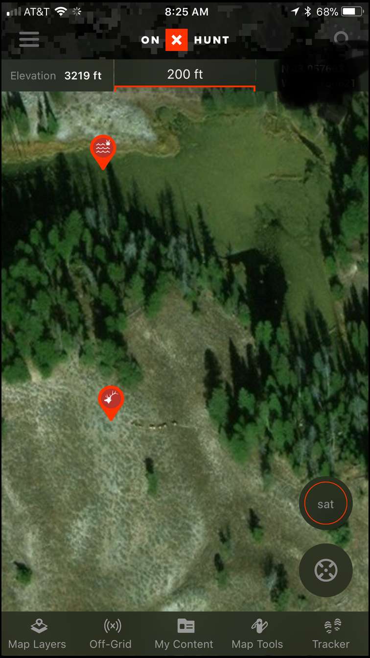

I like using the onX Hunt app....has great resolution and easy to navigate. Pretty sure I even spotted elk earlier this week on an area I was scouting.
From: Senyak70
26-Feb-18
Thanks all, I wanted to share my process so far on how ive attacked E-scouting since moving to MT. So the first thing i did was look for spots of public land that were: A.) Close to where i live B.) Spots with rough looking terrain that look like muley habitat C.) Spots that had road access of some kind. I dropped a point on all of those, and just labeled them Muleys. Next i downloaded a public land KMZ file to google earth so that ultimately i could see how the terrain lays in the spots i marked. I then exported those points from ONX over to Google Earth so that i could see the boundaries of the spots i marked and also see the terrain and do some editing of my own. Ive gone through about 45 different spots and im in the process of narrowing that down to about no more than 15 to really dig into. Im now in the process of marking the following that is either in or close to the public land ive marked: A.) Feed ( Irrigation pivots, haylots etc) B.) Water ( stock dams, waterholes, stock tanks) C.) North facing cover that looks like it may hold some bucks D.) Road Access ( Roads going through the public land and possible trails that may get used) This is taking quite a while but with all this work, hopefully once scouting season rolls around ill have at least a dozen different specific spots and a few gameplans for each spot.
Let me know what else i should be marking, if im missing something. Thanks for the comments guys

