
Online Topo/Aerial Map viewing
Contributors to this thread:Elk
From: Norseman
04-Apr-17
Norseman's Link
https://mappingsupport.com/p/gmap4.php?ll=37.750531,-119.590496&z=15&t=t4
Found this neat site link to viewing topographic and aerial maps. I apologize if this has been posted before, and if you are ArcGIS users as this is much simpler. But it is a nice reference to save in your favorites. in the upper right you can see a drop down menu and a drop down for changing map view. thought I would share as I am always on it....dreaming up my next adventure. Now if I can just draw a tag.
From: Norseman
04-Apr-17
GMap4....does the link work?
From: WapitiBob
04-Apr-17
yep, it works.
From: rideold
04-Apr-17
Decent site. I had not seen that one before. I like the overlay options. I've been using http://www.hillmap.com/ for quick and dirty viewing because I like the split displays.
From: Two Feathers
04-Apr-17
Thanks - I just added it to my favorites. I'll give it a try.
From: Z Barebow
04-Apr-17
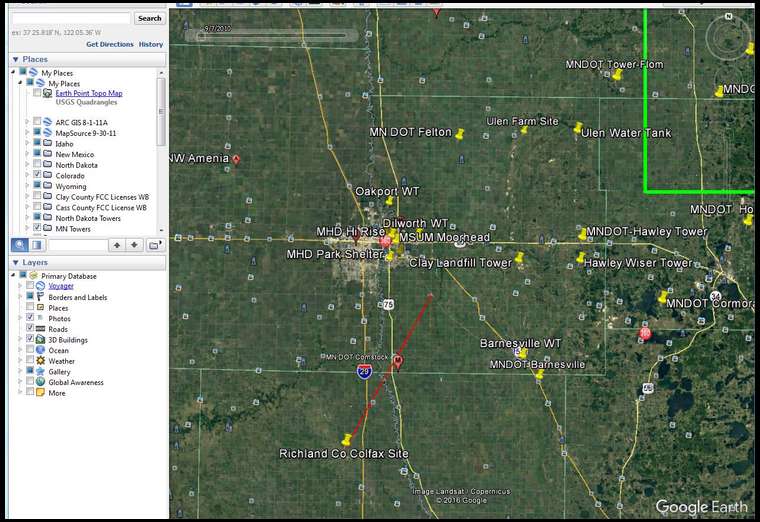
Aerial View

Aerial View

Topo view. Note check under Earth Point Top Map
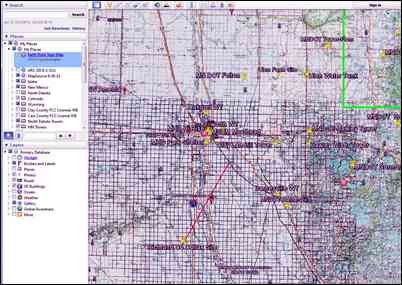
Topo view. Note check under Earth Point Top Map
I have used G4 and it works pretty good. The hi res topo view is sharp.
But I keep using good old GE. I use the Earth Point Topo Maps and all I have to do is toggle it on/off.
This is a view from my work PC. (You won't see any topo changes as we have the elevation profile of a pool table. But I won't show you my hunting areas!) Zoom in via aerial, and then toggle topo view. (Or vice versa)
From: Jayhawk
04-Apr-17
Jayhawk's Link
It seems they have different maps that have various overlay options. Here is a link with their recreation overlays such as trails, forest and wilderness boundaries.
From: Jayhawk
04-Apr-17
let's try again here it is https://mappingsupport.com/p/gmap4.php?ll=38.688256,-98.502859&z=5&t=m,Proclaimed_forest&q=https://propertylinemaps.com/p/public_land_map/USA/USFS_recreation.txt
From: donnybowhunter
29-Apr-17
a great tool
From: nvgoat
29-Apr-17
thanks of the heads-up. Very good site with great map detail and quick loading as you pan.
From: Mike the Carpenter
29-Apr-17
Thank you for the heads up on this site.
From: Muddyboots
29-Apr-17
My son introduced me to hillmap.com. Since then it has been my go-to topo and photo tool (they are side by side). After getting close to the area you want to look at, use the pull down menu on the map and switch it to cal-topo.

