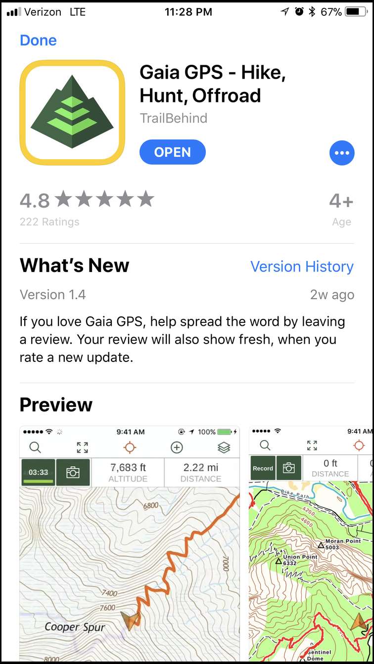
GAIA GPS on your iPhone
Elk
From those who have used it what do you think? Good? Better options?
I used it exclusively this fall. 11 days on Kodiak, 4 in Arizona where I was 60 miles off the grid, and for my entire elk hunt in WY. It works great. It's really all you need besides battery charging ability. I keep my etrex in camp as a backup in case I ever lost my phone.
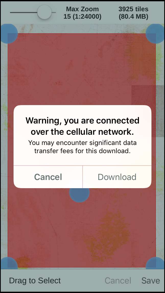
DL the USGS, the GAIA, and the satelite images if you have room because they seem to have their own advantages in certain places, but I used the USGS the most. The GAIA maps are the largest files. Very important: Make sure to adjust your map resolution when you DL to get the highest resolution by sliding the button all the way to the right or else you can't scroll in as far.
EDIT: Regarding battery use, we brought 2 NewTrent battery packs and 2 laptops to Kodiak. By partner and I were both using GAIA on our phones and both used Delormme Inreaches. We burned through both battery packs and one of the laptops in 11 days charging both the phones/Delormmes. Both phones were kept on airplane mode and the Delormmes were left on most of the time, but most of the battery charging went to my buddy's phone as he was using a well-used Iphone 6 and it seemed to go through juice way faster. I only had to charge my Iphone 7 every 2-3 days and we only charged the Delormmes from 50% to full once.
I'm a fan. It's not perfect but it's the best economical option I've found.
I am big fan as well. One more I will add is the NeoTreks land use it is a very helpful map source. I do that one and then USGS Topo over lay on it.
I originally downloaded it into a Samsung Note 5. I now have an IPhone 7 Plus. More map layers available on the iPhone.
Don, I just returned from a 3 week hunt in Northern BC, following a 10 day hunt a month ago up there, preceded by an early August 17 day excursion to the NWT......about 50 days with GAIA GPS on my iPhone 7 paired with a Garmin InReach SE. I'd charge the phone twice a week and the InReach once per week (It uses very little power). Anyway, I just use GAIA "Imagery and Roads" of their multitude of maps. I like the aerial photos.......rivers, swamps, peaks, openings are so visible.
As for a charge pack, I have a large unit that will jump start my F150 V-8 or RZR......done it. Never used more than a 1/3 of it on any hunt so far. Brother bought it in the US at an auto parts store. I backpack with a small battery pack left over from my working days. It will charge the phone twice.
Good luck with it......for $19 and the ability to put GAIA on 5 devices (works great on the iPad with the larger screen) just buy it and try it.
I like it too. Only thing missing is land ownership info and closed/decommissioned logging roads, so I still need to carry a GPS with chip where I mostly hunt. But I love being able to download satellite and USGS maps for offline use and have the GPS features working on them.
I mostly use mine on an LG tablet for the larger screen.
I used it exclusively this year off grid on a few hunts inc Alaska. This is going to put Garmin out of business.
Its no contest between the small screen on my gps and my iPhone 7 plus. I went 4 days in alaska using gps and taking pics without a refresh charge- it uses very little battery on airplane mode.
The only real trick is to download the map where you will be before you go out of cell tower range.
I never heard of this can someone give me a quick lesson on what GAIA is???
A gps app that you install on your phone for $20. No cell signal needed but you have to pre download your maps. I used mine for my elk hunt this year and it worked great.
Bowman, google it.....basically an app for the phone to turn it into a GPS with a great screen and google earth maps, topo maps, etc. The whole world is at your finger tips. And it will work as a basic GPS without saving maps if you change areas. I seem to have some low resolution background even in those areas I don't have aerial downloads.
The major drawback may be the phone memory it takes up. Good luck!
I got a buddy that has it and likes it. He raves about it.
One thing I have noticed is that many of the aerial photos seem to be a few years old. Understandable, since it's a lot of work to continually update them like GE does. I hiked into clearcuts this year that were shown as wide open on the satellite view, but were actually choked with 8-12 foot tall new growth trees.
But for $20 it's a great tool, very useful in many ways. I love being able to toggle back and forth between USGS topo and satellite view of where I am in the woods, so I know that the drainage on the other side of the ridge is too steep to navigate, etc.. so I find a way around it.
The Satelite with labels seemed like a better aerial then any others I have looked at on Gaia.
I actually used the aerial on google maps more then Gaia this year. Just have to have the app open when you have signal and it will hold the picture when you switch to airplane mode.
Can you transfer the tracks and waypoints to Google Earth with GAIA?
Yes it is pretty great. I did not know that you can use the Google maps but I am not sure what you meant, Fulldraw. Can you explain further? Are you saying that you can get the Google maps to use in Gaia?
Yes, I believe you can transfer waypoints to Google Earth from Gaia. They have a lot of short videos at gaiagps.com showing how to do various things like that.
One thing I learned is that if you turn on Record to produce a track, more battery is used due to the constant checking of position along the track.
And check out this link for DBPOWER 300A Peak 8000mAh for recharging the phone or jumping your truck as Kurt said:
I paid $37 and it works great. Not much bigger than an iphone plus but much heavier so would not be great to backpack with.
Bullshooter, sorry for the confusion. I used the app google maps for my aerials. The app requires cell signal but if you pull up the area you will be before you loose cell signal. The app will hold the image even with no signal.
This off-season I will do more research on what Gaia can and can’t do. I do love the app.
Ermine, GAIA was a one time app fee of $19 when I bought it 2-1/2 yrs ago. You can put it on 5 family devices, and we have. Sure beats the 5 broken Garmin GPSs that we have along with a now useless $150 BC map chip. Bet we $1,000 tied up in that.
As per transferring GAIA points to google Earth.......I certainly have no need to do that since I use GAIA for all my aerial recon and saving points. I never run a track as they use a lot of battery on the phone.....and don't know how much memory they may consume.
Per my concerns about some GAIA features in the previous post, The GAIA CEO reached out to me via PM to discuss my concerns, was very cool as we emailed back and forth after taking it off Bowsite. I'm more impressed with GAIA now than ever. When I called customer service awhile back, a very helpful young American woman picked the line right up and answered my questions.
Comparing that to the guys at OnX when I pointed out some MAJOR errors in their chip and they acted like they didn't really care, didn't offer to upgrade mine at no charge if/when they ever corrected the errors. Basically like, "Oh Well".
There is a huge advantage in being able to look at a satellite view on a small tablet in unfamiliar country, see where you are with offline GPS, save waypoints, toggle over to a topo of where you are and see those same waypoints. A hand-held GPS unit is primitive by comparison, so long as you have battery charging capability. On airplane mode my LG tablet lasts for a week or more without charging (I only turn it on when I need to reference something, study a drainage from the air, or plan my next attack on the mountain)
I used onx this year and will continue to use it going forward but, i can say there is nothing it nor Gaia will do that I can't do on my garmin other than make a call. OnX currently does less, Gaia requires file conversion as does the garmin.
Garmin stuck their heads in the sand a cpl years ago and dropped the ball with their Montera. It looks to me like they've simply decided to get out of the hand held GPS market after that model. That model has a hi res display and android os. All they needed to do was remove the 500 tile limit from the custom maps and open up the Birdseye folder so a user could add their own sat imagery. Rewrite the cheesy basecamp program and add 3rd party maps that everybody is using and they'd have a real product by now.
Bob, there is one thing that Gaia can do that your Garmin cant: Buy you enough gasoline to drive from OR to WY and back.
I'm another guy who is unclear about GAIA. Both GAIA and OnX are apps that you load on your smart phone/device and aid you with navigation. I've used OnX for the last three years in four states. From the description of GAIA it seems that they are fairly similar. Both show topo/aerial views and your position and have full GPS functions. The OnX shows land ownership so that you know what is public and what is private. Additionally, it gives the private landowner's info, which is unnecessary (to me) because if it's private I'm simply going to avoid it. Does GAIA show land ownership? The OnX probably has a more user-friendly interface and understandably costs more than GAIA. OnX has mixed reviews with their customer service. My personal experiences with OnX's customer service have been mostly positive.
Does this about sum it up?
GAIA is very simple (user friendly) or I wouldn't be using it!!! Inexpensive as well unless you consider a one time fee of $19 (in 2015) to be something other than a bargain.
GAIA does show land ownership. I had just never added that layer.
Thanks for setting me straight Kurt and Jaquomo.
Bob nailed it in his post. Garmin really screwed the pooch and had the chance to make a really good product...essentially what GAIA is now.
Sell your stock boys.....once the world wakes up to this....its another Kodak waiting to happen.
Just be aware that the land status info on OnX may not necessarily be what it says. According to the chip, I was hunting deep inside Rocky Mountain National Park even though I was miles away and well within the USFS.
Used OnX in 2016, GAIA this Year. I'm going with GAIA after comparing, so far. I like aerial view most of the time, because I'm always looking for ways through and around nasty timber/ deadfall areas. Saw no difference in quality, but GAIA seems more intuitive to me as far as use.
DIdn't realize you could add land ownership layers, thanks for that info, Lou.
Best of Luck, Jeff
Is anyone using GAIA on a android OS with good success? I understand the Iphone version to be better.
I use it on my S8, it's very functional, easy to use and solid app. No issues at all.
Mine is on an LG phone and LG tablet. Easy to work with, especially offline.
Mine is on an LG phone as well...G3.
Does Gaia have a chip for gps units like onx? Or is it only for phones
I went to buy the app and there were several options which one do I get? Hiking & running? Classic? Topo bundle? Hike hunt offroad?
This is the one. I also bought the map bundle as well.
Looks like they are now a subscription model now with either a 19 or 29 dollar per year membership. 29 gets you all the public and private ownership layers for the US.
As far as private ownership goes, it looks like Gaia does not have ownership information, like who owns the property, right? It just has USFS, BLM, state property and then everything else is just "private", right?
Deertick, according to the link below on the new premium membership, they show full details on private ownership.
https://blog.gaiagps.com/access-private-land-data-for-the-us-with-a-premium-membership/
How many have upgraded to the Pro version. I really like it and thinking of the pro version for the better sat maps
Gaia is great! I wouldn't go without it.
I have the premium version and I have been playing around with it and it works awesome! I don’t ever see myself using a GPS again or spending $130 on each state topo chips from onxmaps
The warning is because you're using cell data instead of wifi.
If you have an unlimited - or high volume - data plan on your phone, which most do these days, then it's not an issue.
I added the premium features to my tablet and really happy with it - especially the land ownership info overlayed onto USGS topo, and the timber harvest layer (for finding clear cuts). I'm just digging into the all the different options. Good stuff!
I use it and love it. Very nice piece of software.
I'm signed up and using and so far I am liking it. Are there any particular layers that y'all think are best for hunting? There are tons of options for layers and just wonder what are the best ones for topo/private/block and federal lands
Besides the ones I listed above, I'm also loving the USGS topo overlayed onto the satellite view. You can adjust the opacity with the little toggle on the layer labels by tapping the label.
Hows the coverage of data layers in Canada? (topo/burns) And hows the functionality of waypoints, tracks and management ect ? I am having a hard time justifying purchasing a GPS when I already have a smart phone.
Just got back from a trip where I used this exclusively. I was happy with it but wanted to clarify a few things. First is uses satellites not cell towers right? Also I could not see ownership - how do you view that? I have premium membership
It uses satellites AND cell towers, if they are available.
I would say that the layering wasn't incredibly intuitive for me the first time around, but it works for me now. Overall, I'm very surprised to have liked this as much as I do. I didn't expect that.
Don, there's a US Public Land layer ... and then there's a Private Land layer. You want both of them (I think) and you'll see ownership then. The one thing I don't like about the ownership layer is that the writing is so small my eyes have trouble reading it -- but I know it has to be small to fit the format (iPhone).
GAIA works fine without cell towers. There aren't any towers where I hunt in many areas of BC or the NWT.
It will use towers if available, along with satellites, but I usually am in airplane mode with Bluetooth and Cellar turned off to conserve the phone battery anyway.