Custom Blown Up Maps
Contributors to this thread:General Topic
From: Rwd3
17-Dec-17
Does anyone have a preferred method for blowing up terrain/topo maps to poster-sized? Would like to have one made for my dad for Christmas - I really like the terrain type view on google maps but not having much luck blowing up myself - becomes way too pixelated.
From: White Falcon
17-Dec-17
In also!
From: bonehead
17-Dec-17
hunting maps.com is easy and reasonable
From: expeditiontraders
17-Dec-17
Is it huntingmaps.com?
From: Halibutman
17-Dec-17
Mytopo.com is really a good service. I've used them for a couple of aerial photos I've given to my father.
From: Charlie Rehor
17-Dec-17
If you’re serious check out “Hunterra” Beautiful custom maps you design.
From: Mule Power
17-Dec-17
I use Game Planner Maps. You can customize the boundaries of your map and add any layers you want..... water, topo lines on satellite imagery, unit borders etc and they come in nice waterproof material.
From: IdyllwildArcher
17-Dec-17
mytopo you can make some really nice custom paper maps. I've had several made. Remember the default is rolled up, so if you want them folded, you have to change the setting. Rolled maps, IMO, are not conducive to hunting.
From: Killbuck
17-Dec-17
Try TerraServer.com
From: expeditiontraders
17-Dec-17
I just ordered from Hunterra. I will post some photos when I get it.
From: DRR324
18-Dec-17
I believe the Midwest Whitetail guys use Hunterra, looks like great stuff
From: South Farm
18-Dec-17
I use mytopo. I think they have free shipping right now.
From: CurveBow
18-Dec-17
I also use Mytopo. Good results and can get laminated. I've purchased several maps from them with good results.
From: Habitat1
18-Dec-17
On growing deer tv there was a 20% discount
From: SJJ
18-Dec-17
Nothing compared to the Bing Map "birds Eye View" in my opinion but they recently scrapped that...
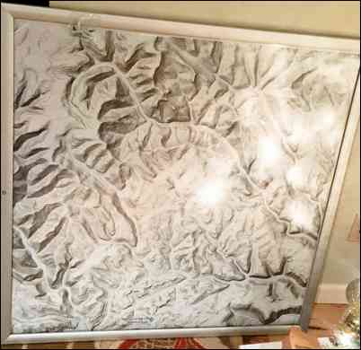
From: Rwd3
25-Dec-17
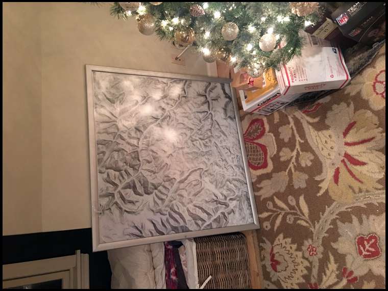

So I wound up taking some advice on here and managed to piece together a few screenshot images in PowerPoint and then had a poster print service blow it up and ship it to me. I think it turned out pretty good and wanted to share. Size is 36” x 36”
From: Rwd3
25-Dec-17