Plastic National Forest Maps?
Elk
Never saw this but the National Forest map I am looking to order comes in paper form or plastic? Is plastic foldable? Seems like plastic maps would be better?
Get the plastic. Will hold up a lot better. Especially if it gets wet.
You can't write on the plastic. Get the paper and then apply contact paper to the back. Lasts longer than just paper, and you can write notes on the map as you use it over time.
HDE, on plastic maps you can write on them with map pens is what we called them in the military. Can clean them off with hand sanitizer and you have a brand new map again. I’d go plastic, but if there’s a big price difference you could get paper and laminate them.
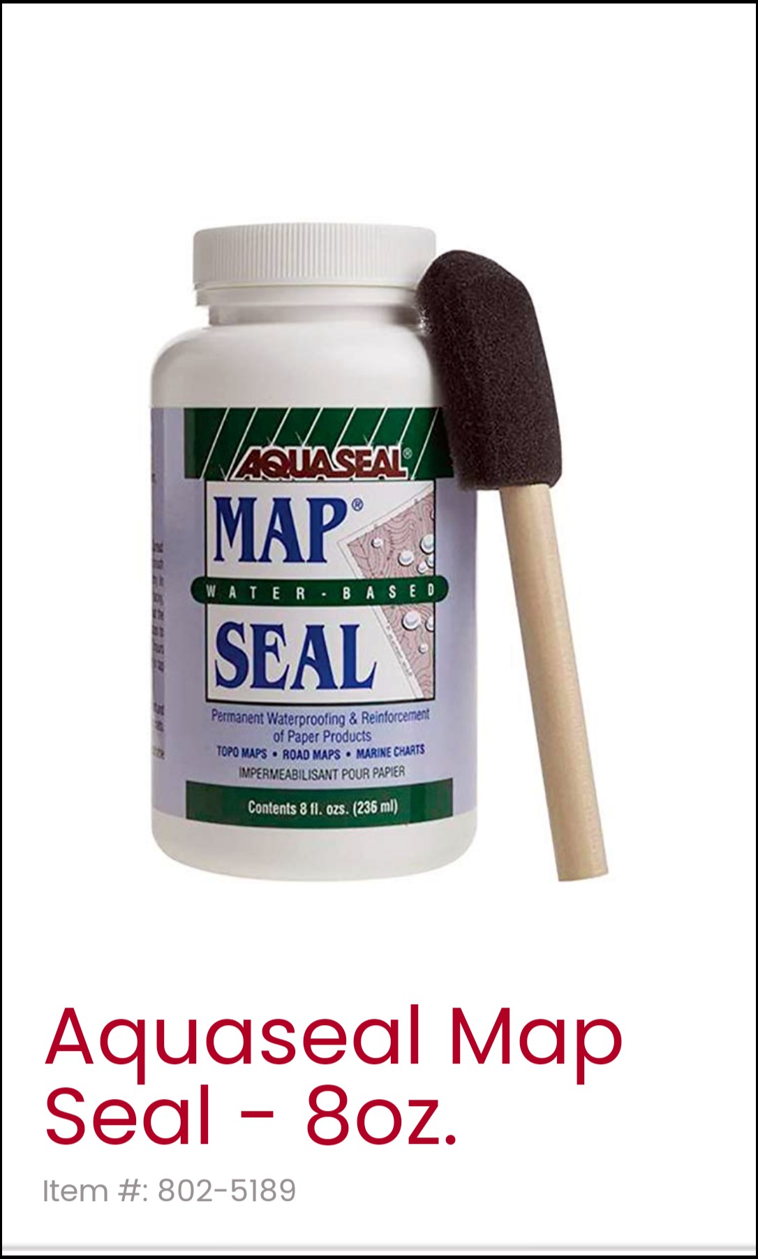
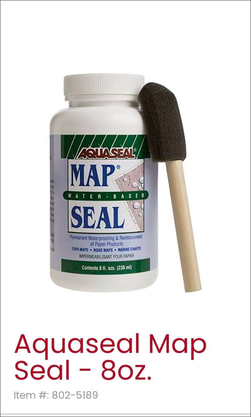
I used to download and print my own USGS topo maps on heavyweight paper on a big map plotter. I had good luck sealing/waterproofing them with Aquaseal map sealer. It comes with a foam brush but I have a mini paint roller that works better.
Boggs - but when you lose your map pen...
What if you lost your map or mind
I'm not sure if many people are aware but all USGS 7.5' quad maps are available free to download and print from the USGS map store if you have access to a large format plotter. I've plotted dozens of them for free.
Also, National Geographic has a very nice program that allows you to print USGS 7.5' quads on a regular color printer. It breaks them down into a mosaic and several regular size prints make up one quad map to scale and then you just lay them out and tape them together or keep them separate and just carry the page you need.
I’ve had good luck with Trails Illustrated maps. They have contour lines, blm, NF, trails and roads and best part…. Waterproof paper.
I have a few Trails Illustrated maps too and I agree they're good maps.
Anybody else ever have the problem where areas I've hunted over the years is the corners where 4 maps are needed to cover your area? Never seem to pick a spot that's in the middle of one map!
Good info, I do know about the free ones but I like the ease of using a large on with all info. I do not have access to a large printer. Worth the $14, both costs the same. Thanks guys, this was a new one on me. I have ordered probably 20 NF maps and never had this option before.
Cheesehead - are you referring to National Geographic "Topo!"? If so, it's not made anymore. I bought it about 10 years ago but haven't used it in several years.
I make my own custom maps using caltopo.com. They're just on 8.5x11 paper so I put them in a ziplock.
National Geographic still makes the maps. They are waterproof and tear proof. See link. They don’t have as much detail like USGS Quads but they are good to look at a broader area. Nice to carry in a pack.
This thread is like a blast from the past. Young guys on here are asking what a paper map is:)
Bow Bullet, no this is what I'm talking about.
Again. If I wanted some sort of folded map in my pack, it will be a Trails Illustrated map.
Thanks guys I'm starting to wonder if they actually don't make the maps anymore and I have to admit I'm feeling pretty old. I tried to order several maps and all said they were available until I tried to put them in my cart and then they said out of stock?
There is no Trails Illustrated Map for Kootenai?
I order paper maps from USGS. They seem to be somewhat waterproof as a little bit of moisture doesn't seem to hurt them. And, I can write on them, if necessary. They should have them of the Kootenai National Forest. I fold mine to the area that I'm hunting and put it in a ziplock bag. Website usgs.gov. An additional benefit of the USGS maps is using it with my InReach. Paired with my phone, I can download the same USGS map that I have in paper form in my pack. For the youngsters, if you're going into remote areas, you really should have a paper map and learn how to use it with a compass. Anything electronic can and will fail you when you most need it.
Still no Kootenai, when I call now no one answers and I leave a message and they never call back. I am out of ideas, except downloading and printing myself. Trails Illustrated and USGS do not have Kootenai! It has been 3 months
Don You might try contacting LL Bean. They used to have a machine in their Freeport ME store that would print out the map you selected. This was 20 years ago. I can't remember is it was just for Maine or Newengland. Nothing like geeking out studying every nook and cranny on a full size paper topo map Erik
I thought for sure this was an old thread dragged up from the past.
I've got a tub full of FS, BLM, National Geographic, etc. maps from CO, MT, IL, AL, MO, and probably some others that I rarely glance at these days. I used to print aerial photos and tape them together and have nearly forgotten what that's like. Young guys likely have no idea..... driving while staring at a map and an aerial photo trying to determine if I'd made it to public land.
I rely on OnX and Basemaps now on my laptop and my phone and likely will not go back. It's too efficient, too easy, and too effective.
But.....I still recall the maps arriving in the mail and pouring over them.
https://mapstore.mytopo.com/
Mytopo will actually customize yourmap. I have one, laminated, that has topographical information printed over an aerial photo of the locale.
Dana C X 2 Topo over aerial photos is the cats ass for working in the woods
It takes a little learning but if you want to make your own geo-referenced maps including topo over aerial Q-GIS is a free program you can make your own maps with. Then you can pop the map over to your phone or tablet and use Avenza maps.
GamePlanner dot com. Printed on waterproof vinyl. You can pick what you want. I give him the 4 corners of the area I want on my map. Also instead of carrying two maps I get mine printed two sided. I have him highlight all the water too. They last forever.
Thanks guys - love the simplicity of NF maps, and "big picture" roads etc. But need to roll with the times. I have printed the unit out on 8.5x11 and taped together:)