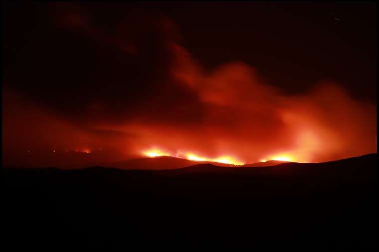
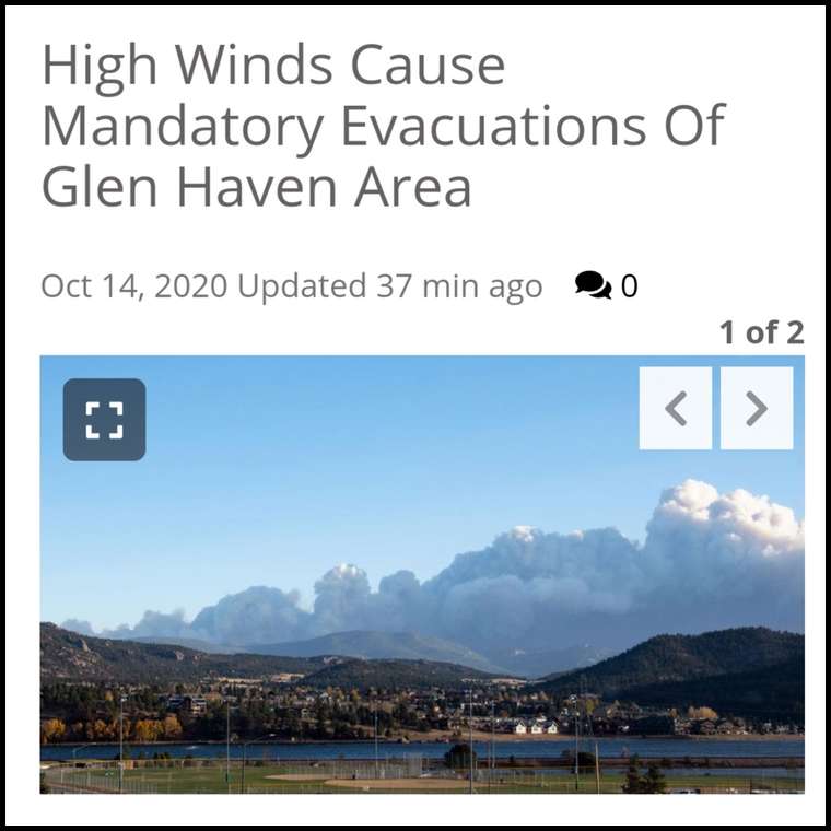
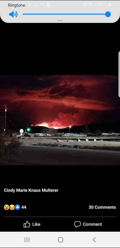
Fire in Rawah Wilderness CO unit 7
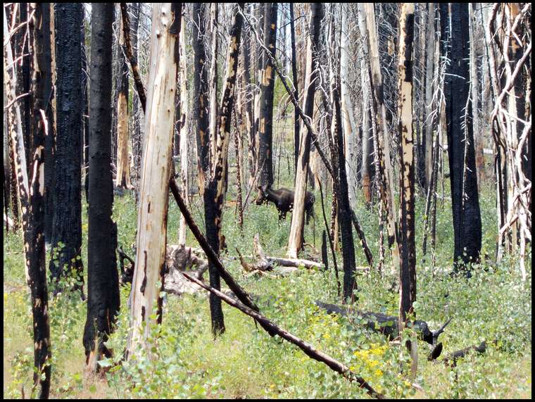
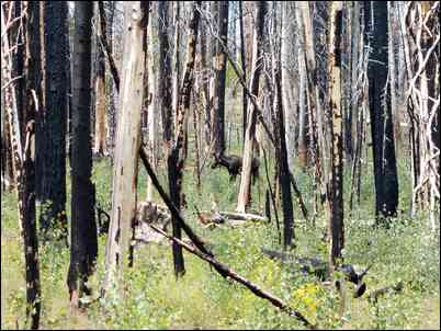
Elk
For you guys who hunt the Rawah Wilderness...theres an out of control fire burning in there west of Chambers Lake. Too windy to bring in air support. That whole area is massive beetle kill so they will likely let it burn. Could go until the snow flies. This could be a bad one...
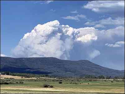
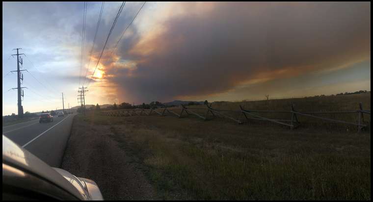
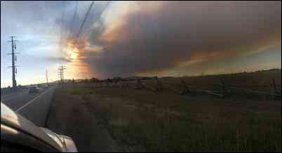
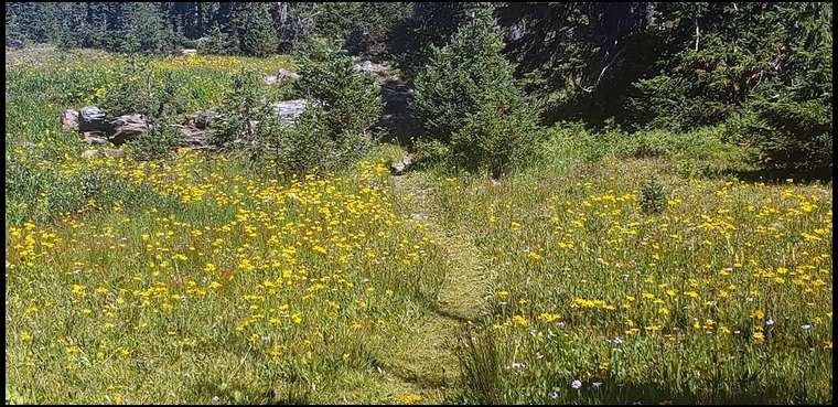
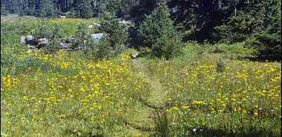
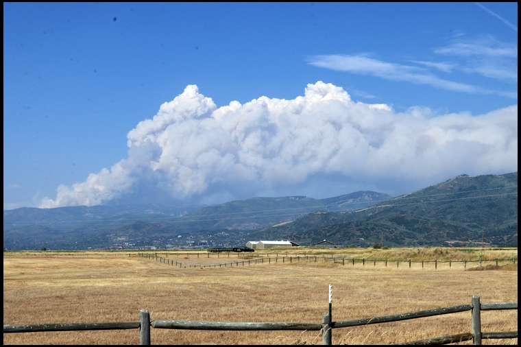
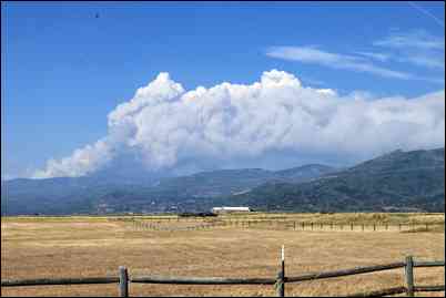
Pic taken from the North Park / Gould side. Hwy 14 closed
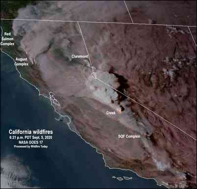
Pine Gulch fire burning 18 miles north of Grand Junction is over 68,000 acres with 7% containment.
Is that burning in the State Forest?
No, on the other side. Looks like it started around Blue Lake. Wind is out of the west so heading toward Laramie river and Poudre Canyon.
Bad news if it is affecting folks homes and businesses.....With all that beetle kill, a big burn is inevitable. Just an incomrehensible volume of fuel. Has to be a good thing, long term for wildlife habitat.
The Blue Lake trailhead looked like a Subaru dealership the other day, and it's been super dry and windy with a fire ban in place. No lightning up there yesterday or today. I'll bet my house it was started by a backpacker. This is virtually an impossible place to fight a fire on the ground with the steep terrain, beetle kill, and deadfall. It will have to burn, which is the wilderness policy last I checked, and they'll protect the very few structures by Chambers Lake and Laramie River.
Man that’s crazy. I just drove the Poudre Canyon last weekend headed to Walden. Glad I don’t have that tag this year.
We were backpacking in Rawah Wilderness Area last weekend. Camped one night at Tunnel Campground. Did the loop around Sheep Mountain and camped at Upper Sandbar Lake. To my knowledge there was no fire ban. At least a fire ban was not posted at the trailhead nor at any campgrounds. Yes, all campgrounds were full except ours at 11,000ft.
The winds were fairly strong last weekend and I’ll bet Jaq is right and a campfire got out of control.
We camped at Bockman last weekend......sheesh.
There's been a county-wide fire ban for several weeks. Unfortunately, they only post the signs at the bottom of Poudre Canyon and as you enter from the Walden side. They need to post signs everywhere. But people ignore it most of the time anyway.
Took the kids up backpacking a few weeks ago. It may screw up my plans on trying a few spots but it is due for a burn.
On the bright side, those burns will be a wildlife magnet in about 3 years.
Matt.
Biggest problem with burns is they are more of a hunter magnet than animal magnet tho I do agree they are good for the habitat
That whole area needs to burn. They should be able to protect the structures unless it blows down to Rustic. But it appears to be going west toward RMNP, Long Draw, and the Comanche Wilderness. That's the latest evacuation notice.
Burns are the worst kept secret there is now. It should be good for some mushrooms!
Burns and Wilderness. The ultimate NonRes elk hunting areas!!
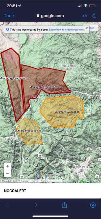
Crap, they just issued a mandatory evacuation for everyone south of the road 3 miles south of me..
Would that be the 74 road jaq?
I love porcini mushrooms. almost as much as back-strap.
Matt
Everything south of Deadman road from Laramie river to Boy Scout road. We would need south wind to push it this direction, and no south wind is predicted for the foreseeable forecast.
Good luck Lou, Our prayers are with you and everyone in the burns path. Please keep us posted.
I hope it stays well away from you Lou!!!! Conditions as prime for bad chit to happen quickly.
Prayers Lou. I hope it stays away from your place.
I agree, they should post signs in campgrounds and trailheads. I drove all through that area last weekend. I seen no signs but plenty of campfires. Camp host was even selling firewood.
Thanks - I'm figuring out how to pack a big freezer full of elk meat, salmon, and walleye and four big mounts that matter into my pickup. I don't think GF and I can get the elk and caribou down off the high wall by ourselves so they may be left for prayer to protect. Hoping it doesn't come to that.
Damn jaq hopefully it doesn’t come to all that buddy!
In Roosevelt National Forest fires are restricted to "official" fire pits only in campgrounds. No fires in rock-ring fire pits in dispersed campsites or anywhere in the backcountry. So if you were in Tunnel campground, ok. Back at Sand Lake, nope.
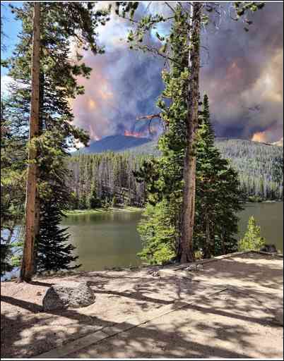
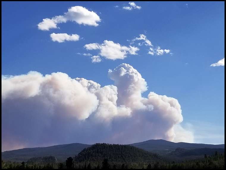
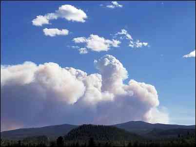
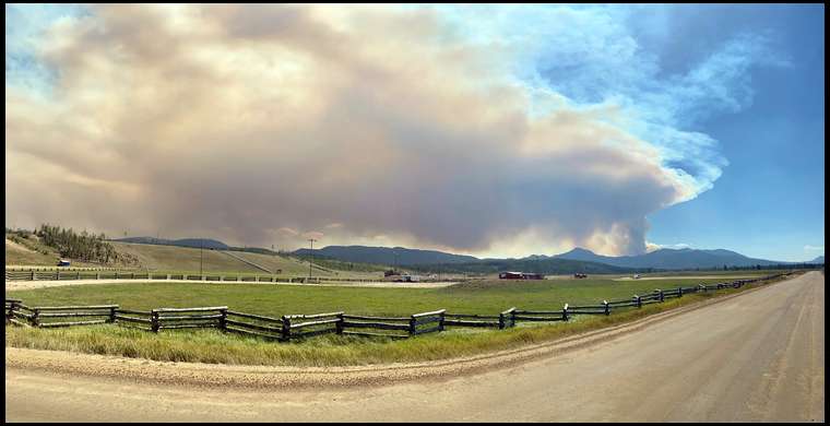
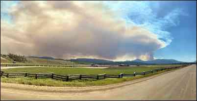
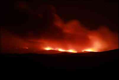
Smoke plume seen from my place this evening
Lou you said “ it appears to be going west toward RMNP” did you mean east or is this fire burning somewhere else than where I think. If it where I think it seems RMNP would be SSE? It is not posted on Inciweb yet.
See link. Fire grew a lot this afternoon
Sorry, east toward RMNP. Directional dyslexia..
This thread is what nightmares are made from, for me. I had to evacuate a few years ago. There's nothing quite like consolidating everything that matters into a pickup and trailer, with 3 horses, 2 dogs, and 2 cats. Fortunately, the fire spared our neighborhood.
Prayers sent, Lou.
Matt
We all dream of living in the mountains. This is the reality portion of the dream. I’m selfishly worried about one seasons hunt And people have to decide which things to save and which to potentially lose. It puts losing one hunt into perspective.
Prayers Lou. I know the suck feeling. We were evacuated in the Bitteroot after they let a non Wilderness fire burn out of control before a big wind direction change sent it roaring our way. Surely there’s someone to help you with the high mounts! My gut tells me you’re fine though for what it’s worth.
Prayers to my northern CO friends....stay safe!
Wish I was closer Lou! All I can do from here is pray you and yours stay safe and the fire changes direction....
Prayers from MN also Lou, wish I was closer I'd be over to give you a hand in a heartbeat.
Brad, from your pic it looks like you might not be that far away, are you in danger where you live?
No issue from the fire where I live. COVID has a better chance to get here than that fire does.
The fire and closures has a huge impact on hunting deer, elk and moose in units 7, 8, 19 and maybe some residual nearby units.
Hope it eventually burns out, but the Forest Service usually lets it burn especially in beetle kill areas.
Wow!! Prayers for you guys.
Tripled in size overnight. USFS is in "let it burn" mode. With the closures and smoke, this is going to affect a LOT of hunters.
"Approximately forty firefighters continue to focus their fire suppression efforts on public and firefighter safety and assessing values at risk."
All I can say is we're thankful for a little NW wind this morning. When it shifts to the southwest it will run right up into Wyoming I'm afraid. Hope you all are safe and don't lose anything.
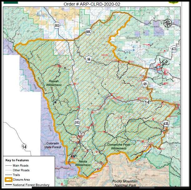
Here's the closure order: Wow
Holy Smokes ... view from Laramie is dramatic ... going to clear out a lot of territory!
I agree Deertick, that fire look ominous from town here in Laramie. Won't be long and it will be in the burn scar from the Badger Cr fire in 2018. Hoping you all are alright down there.
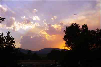
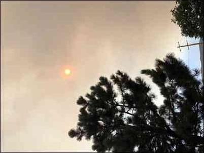
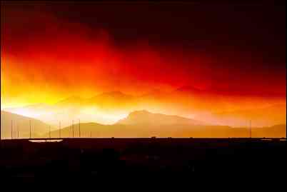
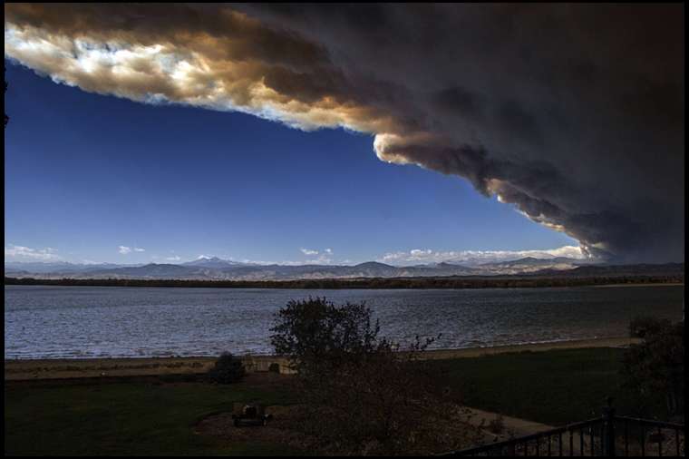
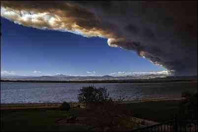
An unedited photo from Greeley of sun in smoke. Not sure which fire or a combo of all.
I say unedited until bowsite gets a hold of them. The background is brown in pictures not black.
The pictures above should show up better color here.
Funny, but still no smoke at my place, only two miles from the closure line. Clear blue sky. But in the next valley over you can't see your hand in front of your face. The ridge right behind me is funneling it the other way.
I spent many years going out to Deadman up past Red Feather lakes. Actually lived in a tent on top of the Mountain for 6 months. Years ago there was a burn on Deadman. Who ever said it, lots of beetle kill timber. Wishing the best for those who have too evacuate.
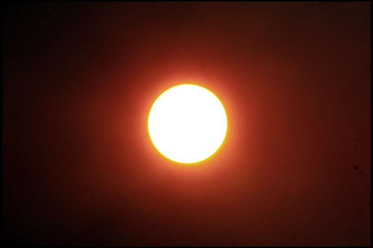
Pic taken at 330pm at my place. Looking directly at the sun. It was supposed to be 96 here today but so much smoke it’s only 80.
Brad that's just smoke from all the marijuana smokers in Denver. The state was having a free weed day. :)
I am so torn about this...I began guiding and hunting in that area in 1991. Might be the best thing for that timber, but I hate to see it happen. Lots of great memories of bulls and healthy timber.
Hope everyone stays safe and the fire does its thing quickly.
Bret
The bulls that lit the fire within me came from that area in 1991 bowbert lol I was born in 88 my dad n grand dad both came home with in my eyes GIANT bulls in 1991
From my friend:
"Got a call from forest service. They say this is a low priority fire until the ones around grand junction are out. Expect it to be 12000 by tonight."
From my place right now.
Yep, I started hunting around there in the 70s, before beetle kill and deadfall made many spots inaccessible. This will be good for the ecosystem but bad for hunters this year
What track is it taking North? Northeast?
The view from South FoCo this evening. Ash is starting to fall in town as well.
The view from South FoCo this evening. Ash is starting to fall in town as well.
Better wear your mask, stay indoors.
Cause?
Pretty much tracking east and north as it spreads. Getting close to jumping the river. There was no lightning anywhere around when it started, but where it started is a REALLY popular backpacking spot to Blue Lake. I'm betting anything it was caused by campers
Evening report said the est. total is 4600ac burned. Fire did spot on South side of hwy 14, about 100ac. burned so far, just West 1/8 mile before May creek & hwy 14. So far no home's or structures have been lost, keep praying it doesn't take anyone's homes. https://inciweb.nwcg.gov/incident/6964/
Trying to stay optimistic that my moose hunt will still happen, should know more by middle next week, this really SUCKS!!
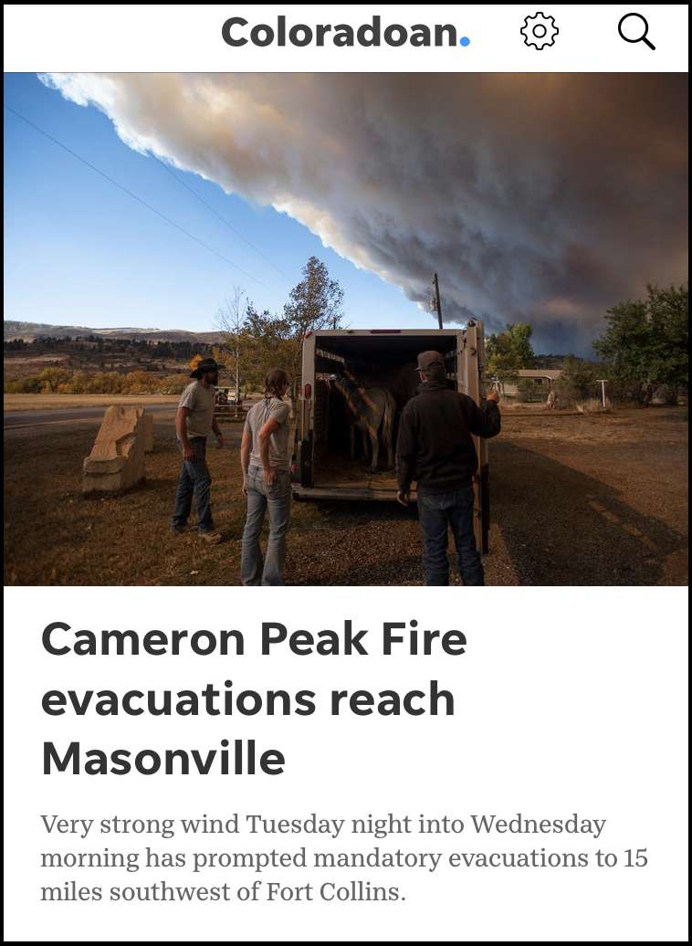
5am Update from Larimer County Sheriff - Justin Smith
"I spent the second day of the Cameron Peak Fire up at the fire as we continue evacuations and maIntaining a safety perimeter around the fire. Unlike the High Park Fire, this fire has been nearly exclusively on USFS lands, so the firefighting operations are being directly by the forest service, so our role at this time is focused on the evacuations, rescues and road closures.
As such, the reports on the specifics of the fire and the firegfigthing operations fall to the USFS. Communications in the Upper Poudre Canyon are challenging, so news has been a little slow so far. We are continuing to work on that.
By the end of the day, estimates on fire size were in the upper 4,000 acres. Given the weather conditions and fuel type, I predict that we will see many more days of exponential growth- but I hope that I’m wrong. There just isn’t much that can be done on the ground with this fire and conditions have not been conducive to the type of air operations that are needed to slow or direct this fire.
We’ve worked to locate hikers and campers in the backcountry and get hem out. We are not aware of anyone in imminent danger, but we have been working to locate and extract a family of four who are reported to be on the west side of the fire. Yesterday, we were able to get assistance from the Colorado National Guard searching with helicopters. I believe the USFS put rangers into some areas on horseback to locate and extract hikers and campers. I don’t know the details on that operations. As of last night, we had not been able to locate the family. At this point, we don’t even know the identity of the family, so it’s been challenging.
I am not aware of any structures that burned. The area of the start don’t contain many structures. Our early evacs focused mainly on dispersed campers in the backcountry along with a handful of established campgrounds. Overall, I’ve been pleased with how those evacs went.
We were forced to begin evacs of structures along the highway in the Upper Poudre near the end of the day yesterday as the fire approached the Poudre Falls area. We have been casting a pretty broad net of evacs in the backcountry as it’s challenging to locate the people camping back there and the last thing we want is to have this fire get up and run and have people trapped by the fire.
I believe the USFS is discussing some broad area closures. I don’t know what those will likely be yet.
We have been working with property owners in the evacuated areas to allow them to retrieve items from their properties when conditions allowed. Just like during other fires, we will continue to do that as conditions safely allow.
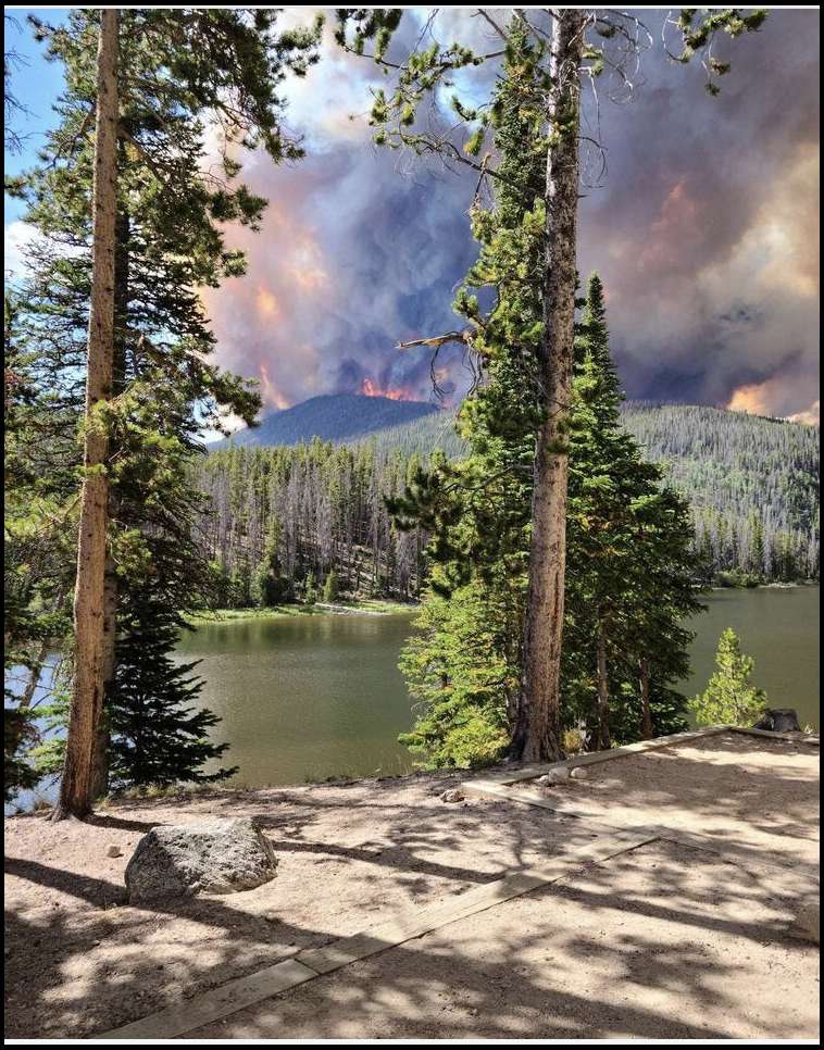
We understand just how concerning this fire is to everyone throughout the area. It’s gut wrenching to watch as areas I’ve enjoyed camping, hiking and recreating in go up in flames. At the end of the day yesterday, I witnessed portions of the Chambers Lake Campground get consumed by this fire- areas that I had been standing in just an hour earlier. I believe there was at least one empty camper with kayaks that was probably burned at the campground. Watching Chambers burn, all I could think of was the hundreds of thousands of memories that families had created in that campground.
As you have read, despite efforts by a handful of engine crews patrolling Highway 14 and a couple of bucket equipped helicopters, the fire spotted and crossed near the Big South Trailhead. I was in the area, but some is so heavy that I couldn’t see where it was burning on that side.
We do have a critical public safety communications site north of the fire that we are paying close attention to (the Killpecker Site). That is the one we got completed after High Park and without it, we’d have almost no communications in this part of the county.
My observations have been that so far this fire isn’t burning like we saw in the early days of High Park. I’ve not witnessed the massive wall of fire, but it appears to creep more below the canopy and then torch up and burn areas of trees. However, the only place we have been able to put eyes o the fire fro the ground has been along Highway 14, so I can’t attest to specific conditions on the fire north of Hwy 14.
Today is a new day and the Type 2 management team the USFS brought in assumes command and control of the fire. We will be working with them as they establish goals and strategies to control and suppress the fire. In my opinion, until they can safely launch large scale air operations, there isn’t a lot that can be done. The terrain and forest conditions are such that there just isn’t much ground and engine crews can do, other than some structure protection.
I truly hope and pray that more positive news can be delivered in the coming days, but I expect we will be on this one for some time.
I am tremendously proud of the LCSO personnel along with our plethora of partner public safety agencies who are stepping up. Those first responders are amazing and dedicated people and you just need to know they are doing everything possible to protect lives and property during this fire.
Signing out to get ready to head back up."
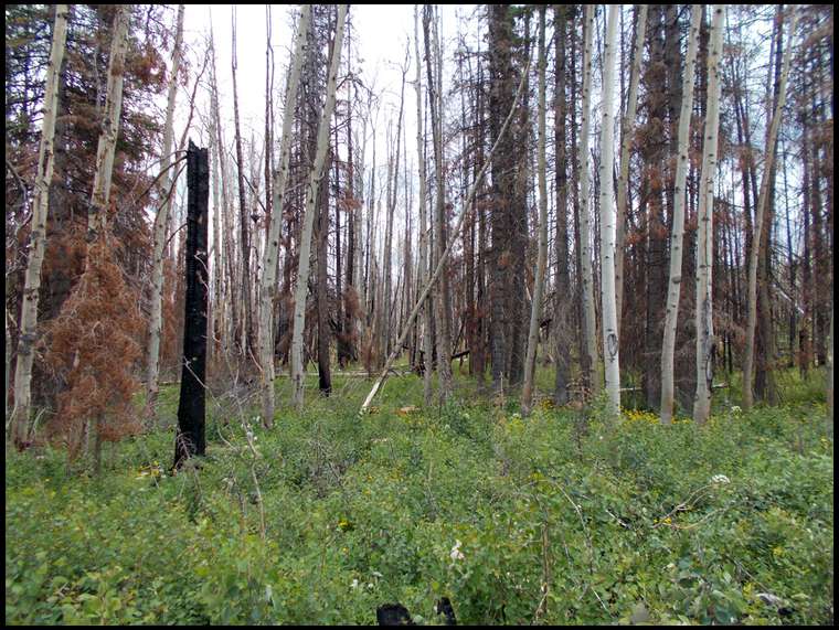
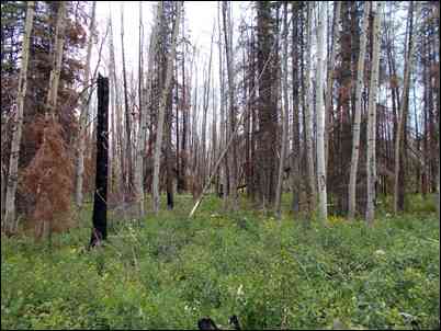
I just want to say thanks to the many Bowsiters who have offered to come here to help us evacuate if needed. Blows me away. We are good for now. The fire seems to be paralleling us and staying in the high-fuel beetle-kill area that needs to burn. One of my best elk spots burned, and now my favorite hunting campsite has burned too. It will be better after it returns, and this is good for the ecosystem.
Thanks again to you all!
Chad,
You've probably seen this inciweb site on the Williams Fork fire. It claims to have been updated 47 minutes ago, but the info sounds similar to what you posted from last night. Is the number at the bottom of the fire's description the same number you've been trying to call?
Keep us posted on anything you may learn. Thanks.
Matt
Oh boy, this is deja vu all over again. I'm sure they'll ramp up containment efforts if it starts threatening Fraser and WP. I don't have much up there that really matters, but I'd hate to see my drift boat and a bunch of camping gear burn.
Please do keep us informed of anything you learn. And know that I'll be up there on a moments notice, if you need any help.
Matt
Im sure whoever started these things was packing granola. Was camped in that area last weekend. Everyone was having fires even with multiple signs posted along the road stating that there was a fire ban. Burn the place down, then go home and vote yes for wolves!
Chad,
I just got an email from a neighbor in WP, who has an inside source at the sheriff's office, stating they are "considering pre-evacuation for Winter Park". Whatever that means. I don't want to push the panic button, but I thought you should know.
Matt
Pig Doc, they will. You can bet they are already doing an inventory of properties, prioritizing by degree of defensibility. The more defensible, the greater the chances it will be protected since they only have limited resources.
I have State Farm insurance and they have contracted with a private company to provide wildfire protection for us if our homes are threatened. I guess that's more economical than paying to rebuild houses.
I just got up to WP. Here is the view looking to the SW towards Byers Peak from Fraser. It appears to be on a path that would miss most structures to the south, but who knows. Skies are blue In WP and Fraser.
Matt
Well, I take that back. The skies over WP have turned a dirty orange just in the last few minutes, and fine ash is starting to fall. Not good, but its still 12-15 miles away
Matt
It's dead calm in the Fraser Valley right now, so the fire isn't traveling anywhere too fast. 50% chance of precipitation starting Monday thru Wednesday. Fingers crossed.
Matt
I will be passing by (twice) tomorrow going to scout an alternate spot. Let me know if you need a hand.
Jordan, how about you stay home for a week of so. Everywhere you go, a fire starts!
Jordan,
For the love of God, please don't go anywhere near the NW corner, right now.
;-)
Matt
Cameron peak fire doubled overnight - today’s estimate is nearly 11,000 acres burning.
Cameron peak fire doubled overnight - today’s estimate is nearly 11,000 acres burning.
The Williams Fork fire has grown to 6000 acres. But they're holding it to the south of Keyser Ridge, which is a main geological barrier to the Fraser Valley. If it gets over that to the north, Fraser and Winterpark could be in jeopardy. As it stands now, it's mostly burning country that could really use it.
The smoke was thick in WP when I left this morning, but it was calm and 50% humidity, so that should help containment efforts.
Here is the most current closure map. If that stays in place for the hunting season, it will affect a lot of hunter's plans.
Matt
PoudreCanyon, this fire is moving S,SE, jumped hwy 14 two places, running along trap/Longdraw Rd and moving closer to East & West sheep Crk. 10,867ac so far. Looks like it crept East a little as well on the North side of hwy 14. In one of the news feeds they said they have been looking for a family of 4 missing, hope they have been found.
Lou, are you still under voluntary evacuation ? Hoping this fire stay's away from your home and all the other residents in the area.
Damn....you guys are harsh! ;) Had a great day with my 13 year old daughter poking around a new spot. The smoke plume from the Cameron Peak fire was visible but not super scary but then we didn't get closer than Walden. Looked like it had moved north. Clear Creek canyon reeked with acrid smoke stank this morning. The smoke haze was spotty through out the day. Above Georgetown it was clear.....in Dillon/Silverthorne it was hazy.
Thanks for the link Pig Doc. Bret
Even though it seems to be burning away from us and USFS is busy working on a fire line between us and there, our drama queen fire chief just informed us to expect a mandatory evacuation in the next week or two. So we're lining up "loaner" freezer space down below and getting the stuff on our evac lists staged to haul down. Sigh. I think this is a big overreaction but this is a strange fire....
Looking at his dept I’d likely be a drama queen too lol.
Good luck with all that Lou, hopefully it won't come to that. Bummer to have to be dealing with that when our favorite time of the year is almost here.
This video gives a good explanation of the Forest Service's current strategy. Praying for everyone's safety. Up to 13,000 acres currently.
So dumb question here. At the end of the video he talks about cutting a containment line from Long Draw rd through the Comanche to the CSU campus. Are they allowed to use mechanical methods in the Wilderness Area to fight fires?
I think when it comes to fire suppression to save a collage campus anything goes, heck I even landed medevac in a wilderness area in 18.
Yes. My understanding is that in general the idea is to let fires burn in wilderness, especially natural caused fires (lightning). But, the Forest Supervisor has the authority to approve equipment, mechanical, air or basically whatever normal methods they use elsewhere when it comes to fires or emergencies.
Another question, Is the fire consuming all the beetle kill trees or is it leaving a bigger mess to walk through.
^^^ According to the the daily fire update from the Incident control, the fire is not burning all the trees, making a 'moonscape' in some areas. The terrain varies so much which contributes to that.
You can get updates if you follow the Cameron Peak Fire on Facebook, or follow Sheriff Justin Smith on Facebook, or Justin Smith in Instagram.
If you dont use any of the above social media, you are subject to Bowsite updates .... :)
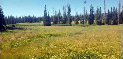
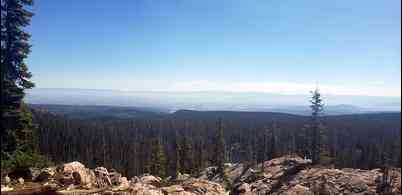
Here are a couple of pics from the Badger Cr fire in 2018 just to the north in Wyoming. We cut firewood in this area. Some spots are still bare dirt and some areas have nice regeneration, but the snags are still standing for now.
Does it burn and clear some of the (pic up sticks) log jams on the ground?
I’m sure it’s dependent on the speed and intensity of the fire at that particular spot.
If it burns the dirt and all the seeds it’s not good. I get the whole let them burn but there’s so much fuel it gets too hot. Maybe that’s the only option but man some of these forests won’t grow back in 3 lifetimes. If you have been to cheeseman reservoir you know what I mean.
It can literally sterilize the ground, where nothing grows back for a long time. USFS folks are studying that situation in the Beaver Creek fire in NoCo from two years ago. Much of it is still barren ground. This fire seems to be burning slower and cooler than that one. But will probably end up looking like wytex's photo when it's over.
Fire crews are trying to direct it up toward timberline on the west and south. That will be a natural barrier. They are establishing other barriers on the perimeters. We dont think it will reach us but are being told to expect mandatory evacuation on Saturday. So we're packing up irreplaceable stuff and heading down the hill.
Any update on those Colorado fires ? Seems there are several Bowsiter regulars in possible dangerous situations and possible loss. You guys are in my thoughts as l can only imagine what you are doing through. My best to all involved...... Badbull
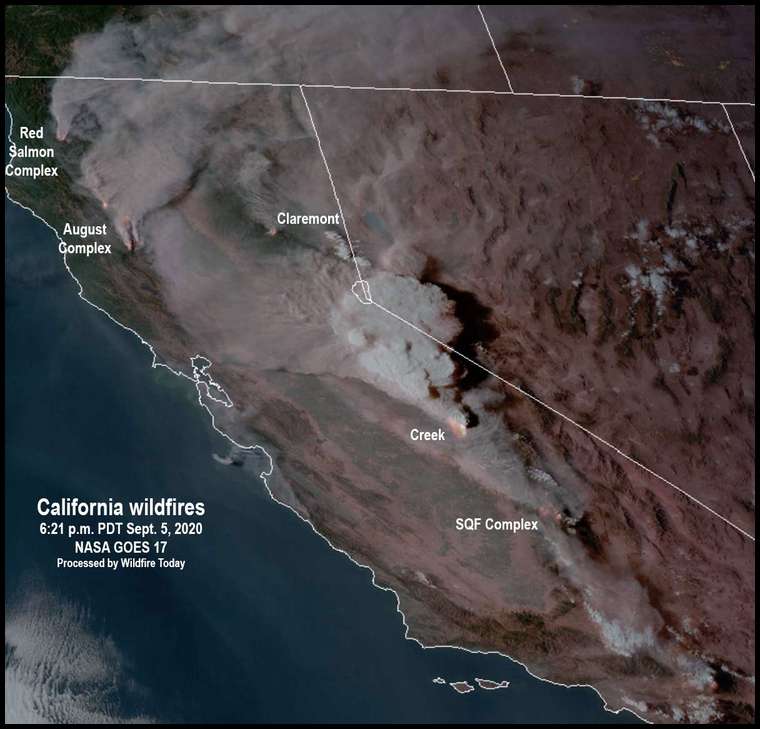
The Pine Gulch fire has blown up. Yesterday it was at 80,000 some odd acres today it is over 125,000 acres. Will be the largest fire in CO history if it gets to 138,000 acres.
Looks like some rain up that way....maybe too far east to help? Looks like Red Feather Lakes is getting some rain for sure. Brang it!
The Williams Fork fire only grew by a couple hundred acres, yesterday. Forecasts are calling for a 50% chance of precipitation in Winter Park from 2-4 this afternoon. Fingers crossed.
Matt
I checked the radar based on jordan's post. It looks like the Cameron Peak fire is getting some rain now.
Lou- any updates? Is the rain going to have any effect on your situation?
Makes sense. Thanks for the info Chad. Glad to hear that risk in your area has went down. Prayers and best wishes.
The radar may show rain, but its so hot much of it doesnt make it to the ground.
This snipnet was included from the Sheriff's morning update I thought was cool. Having a satellite communication device makes the day.
" I am tremendously pleased to report that the final camper in the Rawah area was located and extracted mid afternoon today. Apparently, when he was hiking out, he realized that fire had cut him off from the trailhead and he used an emergency alert satellite communications device to communicate his location and condition and the Colorado National Guard extracted him safely! Way to go COANG!"
Chad,
Your picture of Byers Peak brings back many fond memories of chasing mountains goats up there. I loved and cursed the trail to the top of that sucker, sometimes all in the same labored breaths. I bet the view of the fire would be spectacular from up there.
Matt
So Matt is that as good a Horse Thief? ;)
Horse Thief? Sorry, I don't get the reference, Jordon.
Matt
A little rain fell today but not enough to do anything. Thankfully the wind keeps blowing it away from us and up toward timberline where it will be a natural fire break. Nevertheless, they are making us wait in line for HOURS to get a certified ID with bar code so we can reenter after the evacuation, which we all expect to come down next week sometime. GF was in line for three hours today and got hers. I'm planning to go to the courthouse on Friday to get mine, hoping the line will be shorter if I get there early.
The NW wind is exactly what we need. Funny to see what some people are hauling down the mountain in their trailers.. We're only taking all our meat and other things that are irreplaceable. Honestly I'm not too worried but fires are living things with a mind of their own..
Lou,
If you know what things are truly irreplaceable, and have the rest of the crap covered by insurance, there's nothing to stress much about. I freaked out the first time we had to evacuate. My wife was out of town. I knew what I wanted to save, but I had no clue what she valued. Now I know, and it's literally a few arm loads. I married a great woman.
Matt
Chad, that's too funny..My mounts were the last on my chopping block, and my biggest concern when I left them behind. We're sick brother. ;-)
Matt
Matt, it was a funny thread previously on here where someone promoted hunting north of horse thief peak in a certain unit.......not funny if you didn't participate I guess. sorry
This is serious chit so I truly hope everyone is safe and their possessions escape damage. Insurance claims suck.
Lou, So glad that the winds have been keeping the fire for the most part from going your direction, hope it stays that way. I called & talked to a guy today that is part of the fire team/information center, he said that this fire is currently estimated to burn at least to the end of next month unless we get some really wet weather. From your post you've had to evacuate? Or they're just monitoring who's going in and out?
Cameron fire is 15K+ acres now. Its expanded where it jumped the river and is at the NE end of Joe Wright reservoir.
Here’s a pretty good website for wildfires in the U.S. looks like a pretty good site for fire mapping updates.
Getting stuff out before the mandatory evac is imposed, which may happen when I'm hunting in WY. This "credentialing" CF is a mess. People wait in lines for hours and then the machine breaks...
Really sorry to hear this guys. Hang in there. My folks were in that Black Forest fire about 5 years ago, so I know all about the stress from it, they were living out of their 5th wheel for a month. Kinda makes a guy think about life and material things. But elk hunting honey holes in flames right might be crossing the line. God bless you and your families men. Sending prayers
Seeing good rain on the area on radar....some yellow and orange bands. I hope it is real and hitting the fire.
“ People wait in lines for hours and then the machine breaks...”
Lou, It’s Colorado. No different than Leftover Day
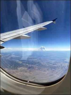
Prayers go out to all affected by the fires. Some scary stuff. I had a connecting flight from Denver on Saturday and could see some from the air.
Another broke out late yesterday between wrist canyon and 14 low in canyon. 60 acres as of 7:30 last night. Haven't heard anything yet this morning, but they jumped on it quick.
Stopped at Ted's on my way home from work. New fire is in steep terrain, fighting it with a helicopter mainly for now. Still not contained, and not sure how much it grew. Updates are usually at 5:30.
It's up to 18,287+ an hour ago, and still growing South and East of 14 and Peterson lake. It's now made it to the Longdraw/Coral creek area by the FS/cow camp cabin, expected to continue along the ridge on East side of Longdraw Rd.
I just mapped out whats left outside the closure for area to hunt on my elk tag that is public, accessible and holds elk sometimes. It didn't take long. I hope tag holders aren't too concerned with social distancing because keeping 6' apart could be an issue. If an elk wanders into whats left to hunt, it will be a choice of whether to shoot or duck.
Alot of area that could likely be opened but as of now id expect cpw to open up some tag return options like they have with the other fires
I think we're seeing some of your smoke here in MN.
For the past 4-5 days it looks like we’re socked in with fog and rain here in Cheyenne, even though there isn’t a cloud in the sky and our highs are in low 90’s. The sun looks like a red ball in the mornings. Today’s the strongest I’ve been able to smell it.
They just added the Cameron Peak fire to the Refund and reinstate Points list.
Unfortunately, that won't help the moose hunters. Trad-doerr could get his weighted points back and wait another 40 years to draw.
Much of that smoke is from the California fires. The Cameron Peak smoke is gracing Denver with a NW wind.
And deer season just became a catfishing trip......
I haven't seen a clear blue sky in central CO for 2 weeks, and we don't have a fire anywhere close....yet. This is the worst burn season I can remember. Just nasty icing on the COVID cake, in my my book.
Make the best of it, guys. Write 2020 off as the year Mother Nature took a crap on the earth.
Matt
Hell Matt....she's just cleaning up some litter and thinning the herds......no one to blame but ourselves for building up the litter and growing the herds. All kidding aside....2020 can kiss my arse. I may kill an elk this year just for spite. Pigs will be flying next.......bears with chainsaw arms. Holy crap........
I'm still pissed that everybody is ignoring Murder Hornets. Murder Hornets Matter.
Well then these fires should be illegal jaq I'm sure this is killing and displacing thousands of murder hornets!
These fires sure have messed up a lot of hunters plans this year, and with the SW corner of the state going all draw this year there are going to be a lot of miss placed bowhunters & muzzle-loaders. WELL! got a call from CPW today stating that the moose hunters/sheep hunters in Cameron peak fire area can turn in their tags for a refund and reinstate PP or a voucher for next year for the same unit. What would you guys do? Mind, it took me 28yrs to draw the bull moose tag.
I'd take the refund and points and hope karma blesses me. IF I had a moose tag. Sheep not sure.
Voucher for next year! Some of the better area MAY be closed still but as hS been said lots of habitat!
By voucher I assume it means guaranteed tag next year? I would take it.
Voucher, and don't look back. This is a mosaic fire, not a total burn. Next year could be amazing for moose.
Well if it ain't burning so hot the area is ruined....hell yes for voucher.
Voucher! We are also displaced from hunting the wilderness area. It’s a bummer because we had 2 Young men on their first big out of state hunt. Oh well, my plight is nothing comparing to the stress of people being displaced from business and home.
There’s no question, take the voucher!
Cameron Peak fire was hit with rain. Only grew by 5 acres this weekend. Not done and too early to predict what will happen, but good news.
A very good friend (92 years old) just killed a 350" bull within minutes of one of the big Colorado fires....it was with a crossbow, but at 92, I decided to cut him some slack....LOL
Jake that is awesome! I hope I am still alive at 92 and if I can still work the remote control I'll be happy much less still hunt.
A few minutes ago from 287 north of Fort Collins. Fire seem more active today.
Just across the wy border
Seemed like it was really going this evening. Hopeful the weather coming is enough.
Took off to the east last night. Added a lot of acres.
The smoke plume looked huge yesterday evening, could clearly see it from south of Denver, Inciweb says it grew 10,000+ acres over the last day or so...
Winds 30-40 mph today ... that ain’t helping.
One more I took yesterday from hwy 34 Between Greeley and Loveland
Winds 30-40 mph today ... that ain’t helping.
One of those years, or maybe not! Whole state of CA seems to be on fire right now...
Another big fire north of Steamboat
so much for hunting north of horse thief.......
Calling for 10-14" of snow up there so hoping that snuff this new fire out ASaP
I was on top of a mountain this morning grouse hunting with my kids. All of the sudden the sky changed and smoke started rolling in. It was thick enough that I really thought there was a fire nearby and we headed down the mountain. The entire way up i25 the smoke never quit and I realized the smoke was from the Cameron peak fire 200 miles north. Insane!
Looks this fire might had had another blow up today. Anyone have any info pretty limited on inciweb.
^^^ Ya think? 70mph winds and 80 degrees?
Heard from my daughter in Kremmling a bit ago there's a new fire behind the Troublesome somewhere and they evacuated Bighorn Park.
Unless its bad info and they're seeing the Cameron Peak blowup??
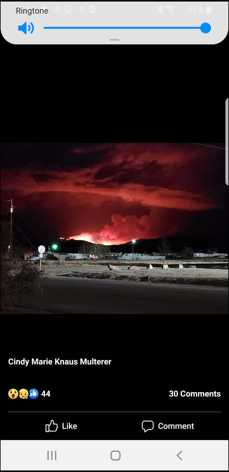
High winds causing this fire to blow up nw of Estes.
Daughter said is a new fire and Bighorn Park definitely evacuated and all the local resources are at the fire.
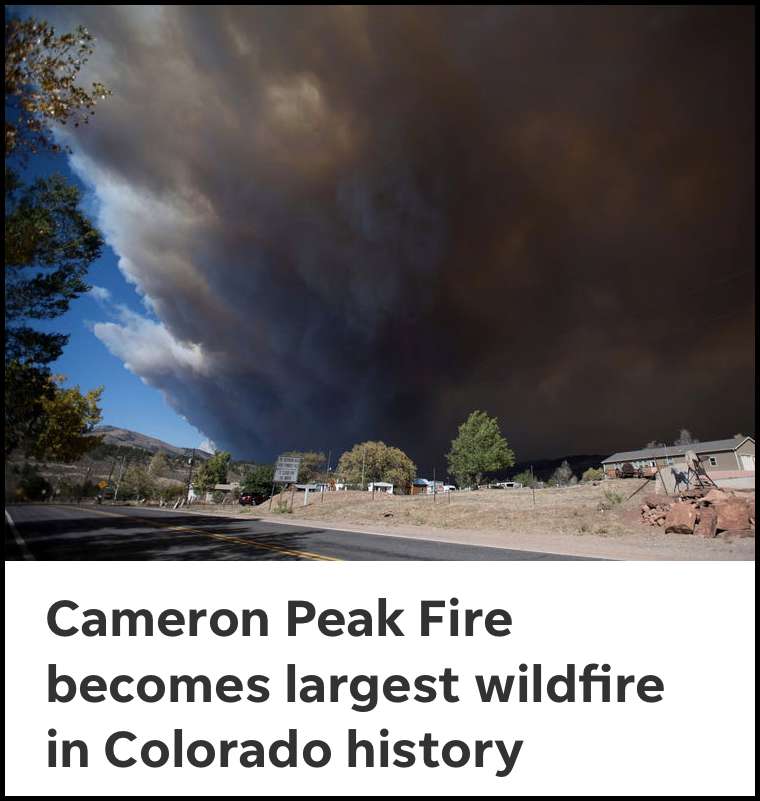
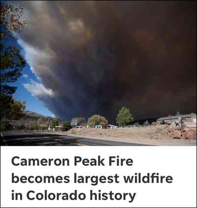
It just took 1st place for biggest Colorado wildfire.
Cameron Peak Fire is now the largest fire in Colorado history. It grew by 20,000 acres in the past 24 hours
View of East Troublesome fire from Kremmling last night.
Here is great link to info on the Cameron Peak fire.
The fire has already traveled 60 miles east from its origin and has reached Stove Prairie Road (CR27). Strong westerly winds are forecasted for today and tomorrow. With the upcoming predicted strong winds and considering the nearly 30,000 acre run the fire made a couple days ago, if the fire makes another similar run it's not out of the question that the fire could reach Horsetooth Mountain Park on the west side of Fort Collins/Horsetooth Reservoir very soon.
I can see the flames from Loveland tonight. Its about to pass 200K acres.
We are now about 3 miles south of the south line of the mandatory evacuation area, although the fire itself is still farther north. Pretty impressive plumes of smoke and heat generated cumulous clouds passing just northeast of us the last few days. And about noon today a new fire, the Calwood fire, started just south of us in South Saint Vrain Canyon. Already more than 7,000 acres by sunset.
Hey Ziek,
Where are you located? I graduated from Lyons, and grew up just South of the Greenbriar Inn off Hwy 36. in Crestview.
If you are south of the Cameron Peak and North of the Calwood fire, I suspect your fairly close by?
With these fires, Maybe the Liberals and Tree Huggers of Boulder County will change their stance on Forest Management and Logging in the future
More likely it will motivate them to support more fees and less freedom to fight man-made climate change.
I shoot at Gamelines archery range and ride my bike up Lee Hill Rd. and Left Hand Canyon alot during the summer...it's amazing to me that only about 20% of the homes in those areas have done fire mitigation work!