
https://www.nrcs.usda.gov/wps/portal/wcc/home/quickLinks/imap/!ut/p/z1/04_Sj9CPykssy0xPLMnMz0vMAfIjo8ziLSycTQz9TQx8DLwNHA0CnS28w8w8wgz9A4z0w8EKPI0sHD0sgg283Z1NTAwcLZ3NQ3yCzQ28Q8z0oyjR72RAnH4DHMCRSP14FEThNz5cP4qQEogCfF7EqwAYhgW5oaGhEQaZno6KigCJo-Ig/dz/d5/L2dJQSEvUUt3QS80TmxFL1o2X0kyOEFIOFMwS0dDNDQwQTlDN1RMUzcwS1I1/#version=125.1&elements=&networks=!&states=!&counties=!&hucs=&minElevation=&maxElevation=&elementSelectType=all&activeOnly=true&activeForecastPointsOnly=false&hucLabels=false&hucIdLabels=false&hucParameterLabels=false&stationLabels=&overlays=&hucOverlays=&basinOpacity=100&basinNoDataOpacity=100&basemapOpacity=100&maskOpacity=0&mode=data&openSections=dataElement,parameter,date,basin,elements,location,networks&controlsOpen=true&popup=&popupMulti=&base=esriNgwm&displayType=station&basinType=6&dataElement=SNWD&depth=-8¶meter=OBS&frequency=DAILY&duration=I&customDuration=&dayPart=E&monthPart=E&forecastPubDay=1&forecastExceedance=50&seqColor=1&divColor=3&scaleType=D&scaleMin=&scaleMax=&referencePeriodType=POR&referenceBegin=1981&referenceEnd=2010&minimumYears=20&hucAssociations=true&relativeDate=-1&lat=39.377&lon=-100.699&zoom=5.5
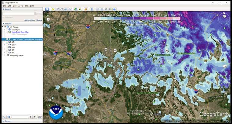
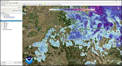
http://www.nohrsc.noaa.gov/snow_model/GE/latest_nohrsc_nsm.kmz
https://www.wcc.nrcs.usda.gov/snow/

