Stuff Found On GE, BaseMap or OnX
Equipment
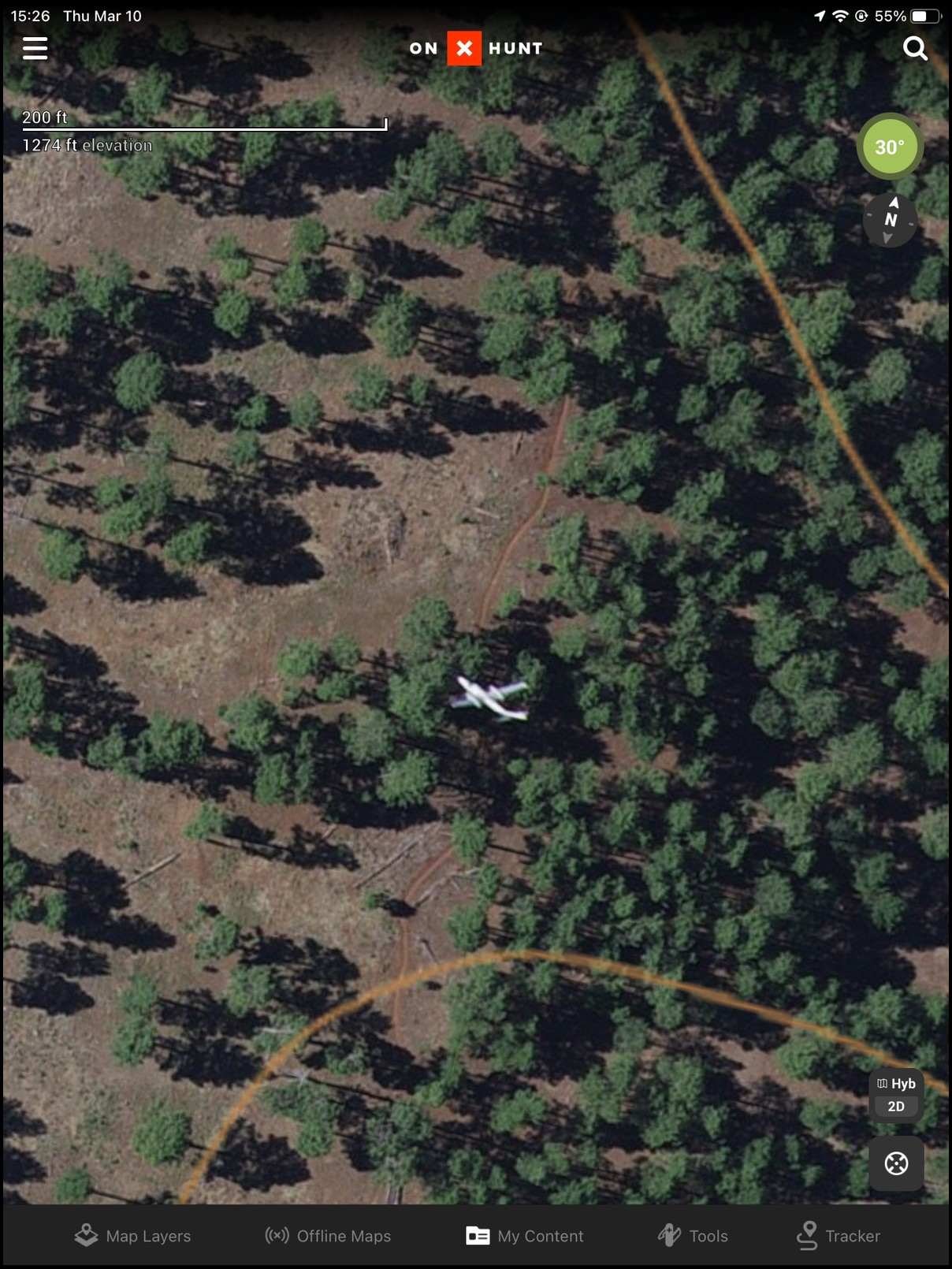
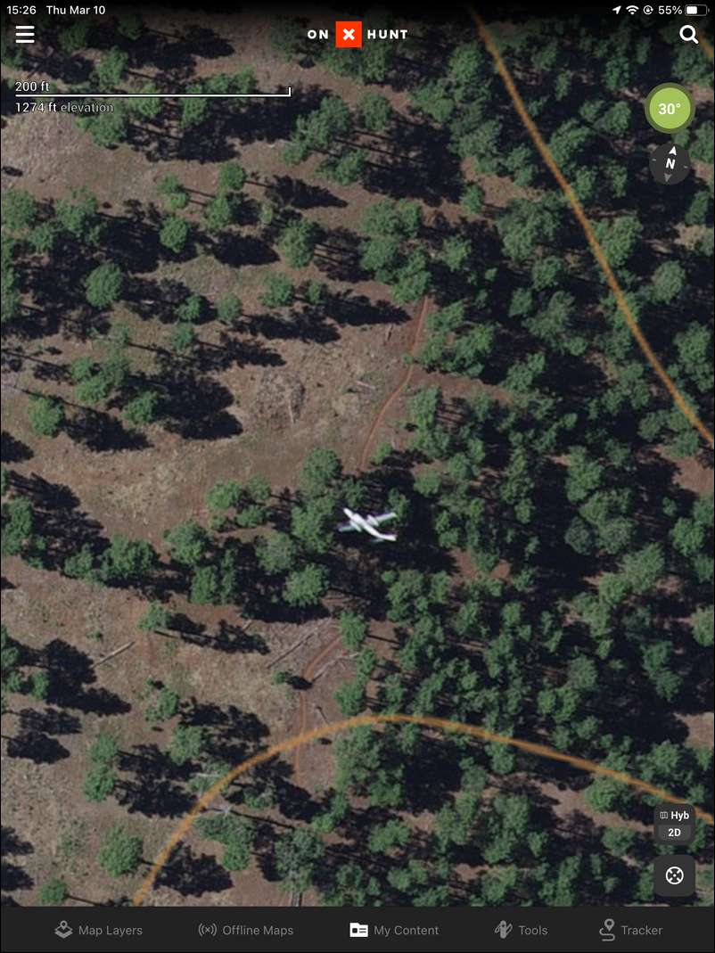
Found this one the other day scouting a spot…
Wow, what do you think made those weird orange lines?
BTW, judging from the length and angle of the shadows created by those trees, if that plane were really there, it seems it would be almost totally in the shade. Just my two cents.
I would say the plane is likely above the trees. ;)
Maybe... What do you make of the end of the left wing? Seems to be in shade or under a tree. I dunno. Just bored I guess.
It’s just the angle of the photo. The left engine also looks closer to the fuselage than the right. In reality I’m sure they are nearly equal.
Pretty sure the airplane was moving when the satellite took the picture from a thousand miles away :) going to be some distortion for sure. Pretty neat

A GPS satellite was taking pictures the very day I set up.
A GPS satellite was taking pictures the very day I set up.
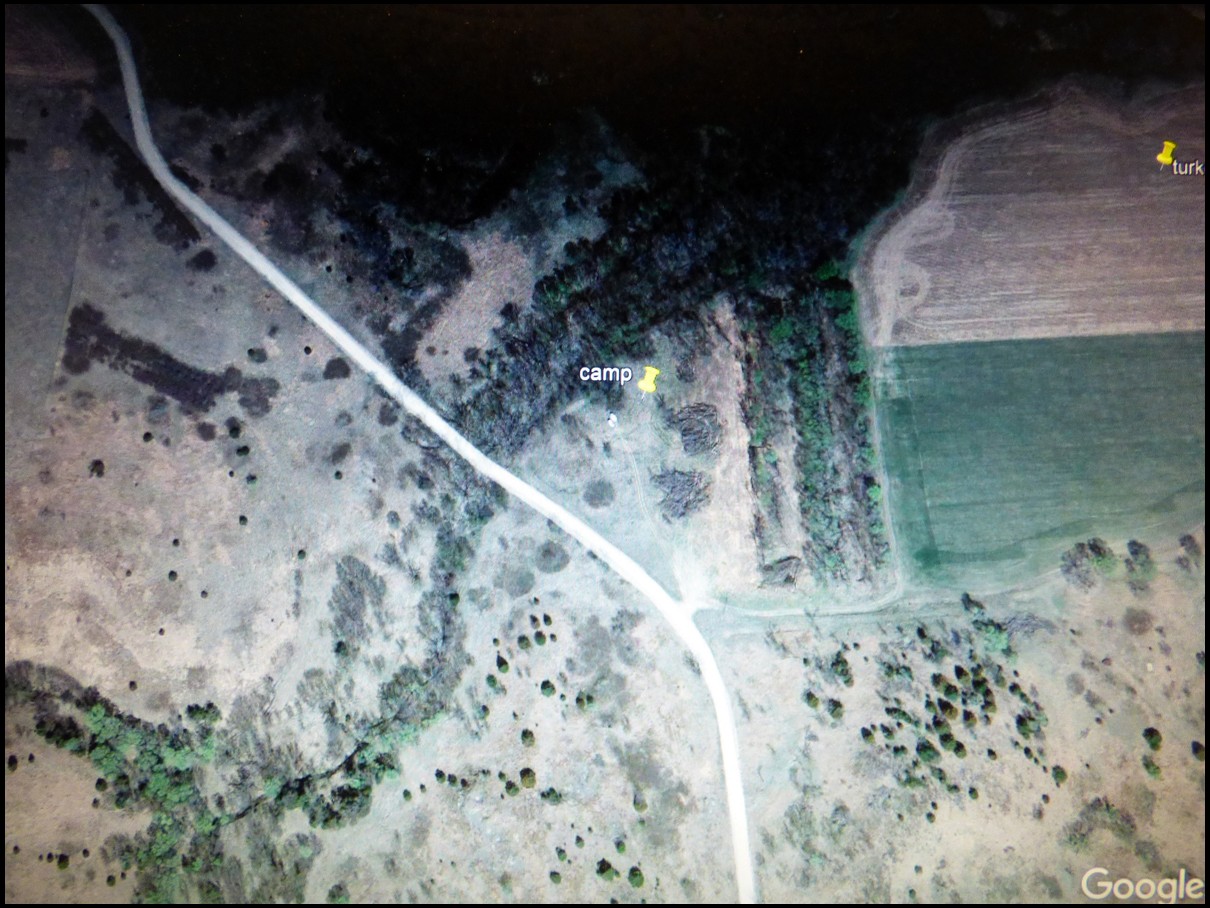
On March 29 2012, I parked my popup camper and truck while turkey hunting in Nebraska. Little did I realize that Big Brother was watching from above.
Pat was just keeping an eye on you!
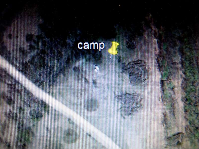
Found my elk camp once on GE. September, aspens were gold, could clearly see my camper, truck, and wall tent. Kind of cool.
When I hunted 61 ten years ago, I found a tree that looked like it was cut out for a stand overlooking a pond. Sure enough. I even hunted out of it.
This topic made me curious. A quick search for update frequency
“In small, highly populated portions of the continental United States, updates happen as often as every week. For places more isolated, the frequency could be as slow as every couple of months, years, or even longer. Regardless, the bottom line is you cannot find out when your area will get updated in Google Maps, although you can see where Street View will go next”
I guess Google and hundreds of other companies use NASA images
I'm guessing that's a low flying airplane captured in the photo. If the plane had crashed in those trees it would likely have significant damage.
BTW, pretty sure GPS satellites do not take photos... At least in the past, GPS was the Department of Defense.
Paul, they must’ve chipped you when you got your Covid vaccination

Wondered what this was, went back a few years and it shows a tree much taller than the rest - assuming it was hit by lightening.
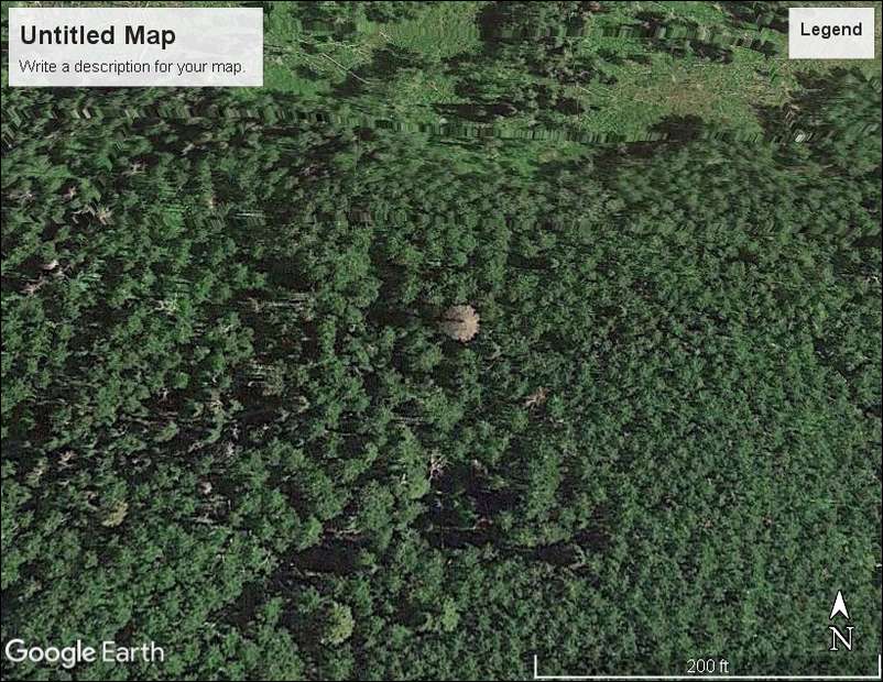
Wondered what this was, went back a few years and it shows a tree much taller than the rest - assuming it was hit by lightening.
Father in Laws place in Ok either him or neighbor plowing his field.
Father in Laws place in Ok either him or neighbor plowing his field.
Too bad GE doesn’t do a special version for hunters the first week of elk season so we can see what trailheads are slammed.
Local government and the IRS already use Nasa images/ Google Earth to show property and building upgrades. States use it for tree clearing and “Wetland” clearing/ draining. I know farmers that have been fined for clearing trees the state declared as wetlands. So they will definitely update the maps more often and release better technology to those entities to collect more taxes and fines
I used to have a picture that showed me mowing on my place. I kept it for awhile, but sold the place then trashed the picture.
I once had a couple trees come down in my yard, cleaned them up the next day. Google satellite took a picture the day that they were on the ground.
I didn't save copies of the images, but a few years ago Google Earth showed the unsightly clutter that had accumulated around my barn. Shortly afterwards, I rented a large roll-off and spent a week clearing all that junk away. The next time I checked GE it showed my barn minus all the junk.
"… I always feel like somebody's watching me
And I have no privacy (oh, oh)
I always feel like somebody's watching me
Tell me is it just a dream?…"
;-)
Matt
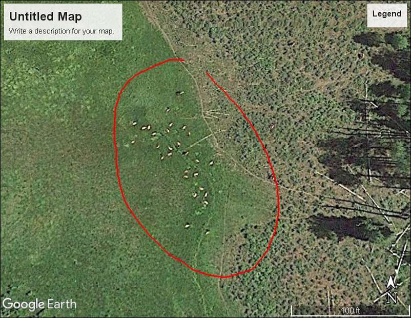
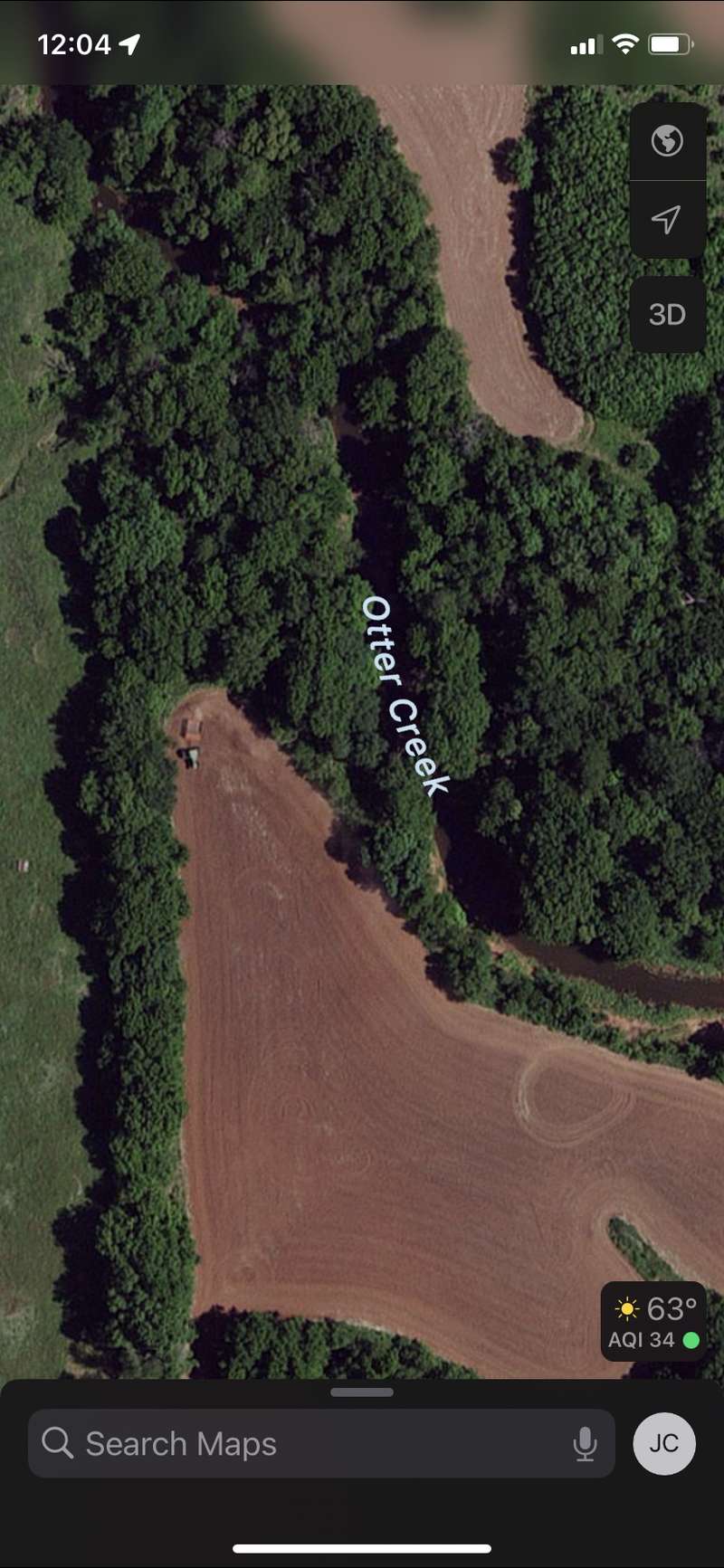
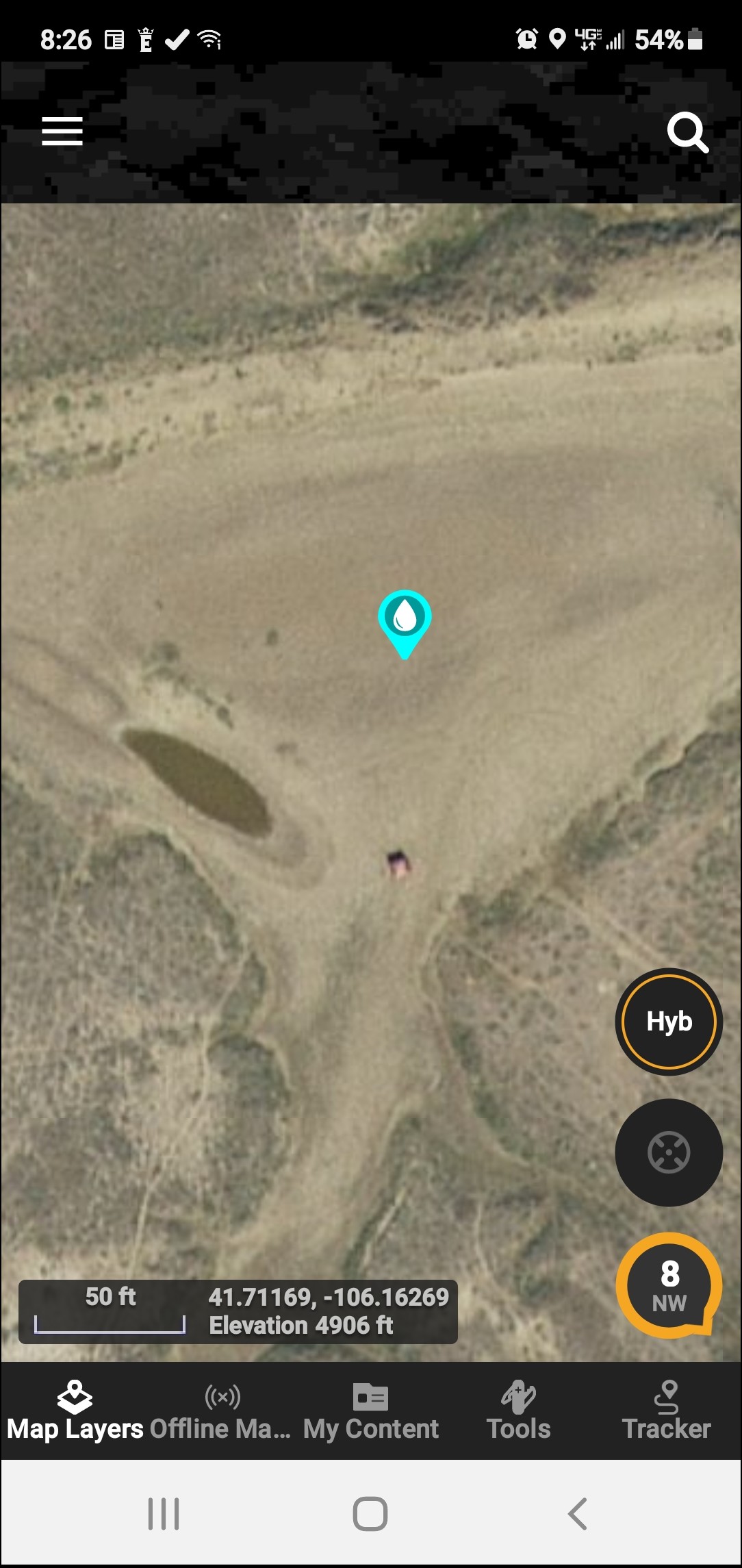
looking for waterholes to antelope hunt. this one looked good to someone