
Just wanting to hear your guys plans. I've been reading the big game forum and lots of info there too. If anyone is looking for a hunting partner I may be interested. I could use the help.
We also applied for some longshots in New Mexico.
Also buying Colorado, Utah and Arizona preference points.
If you are concerned about going solo, pick up a DeLorme inReach to keep in contact with someone. The peace of mind will help you keep at it when it gets tough.


Orion - yes those guys definitely know what their talking about. Appreciate all the knowledge fellas keep it coming. And more pictures!! Love it

I will warn you. Elk hunting is a very slippery slope, but I wouldn't have it any other way.


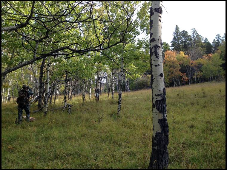


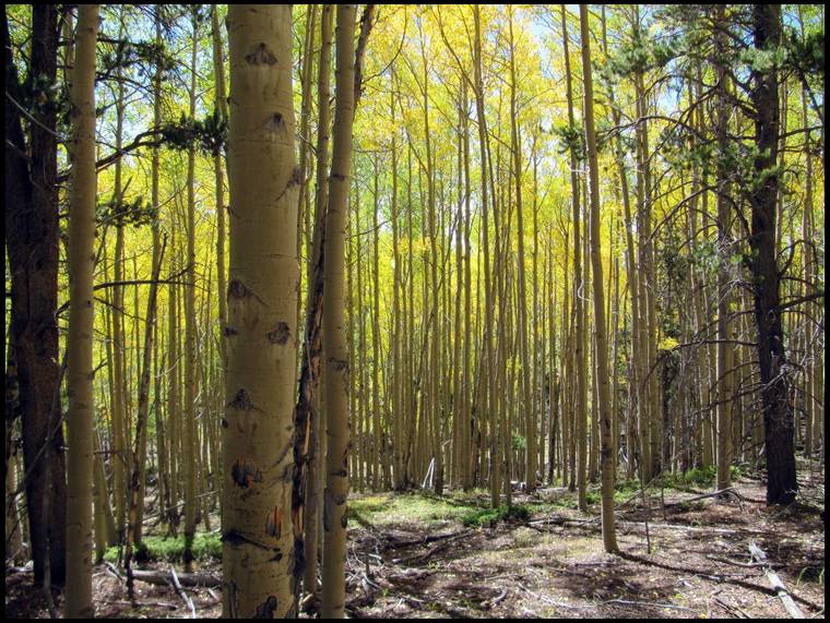
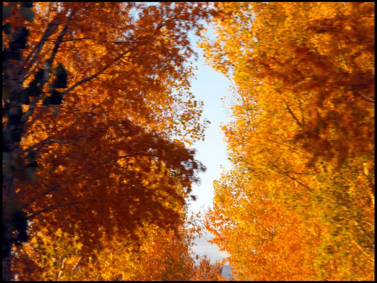
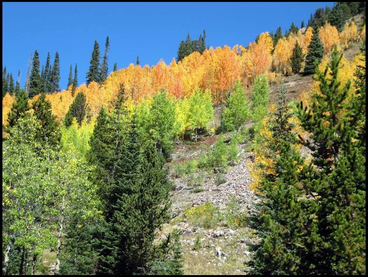
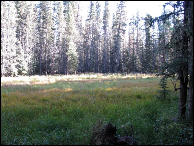
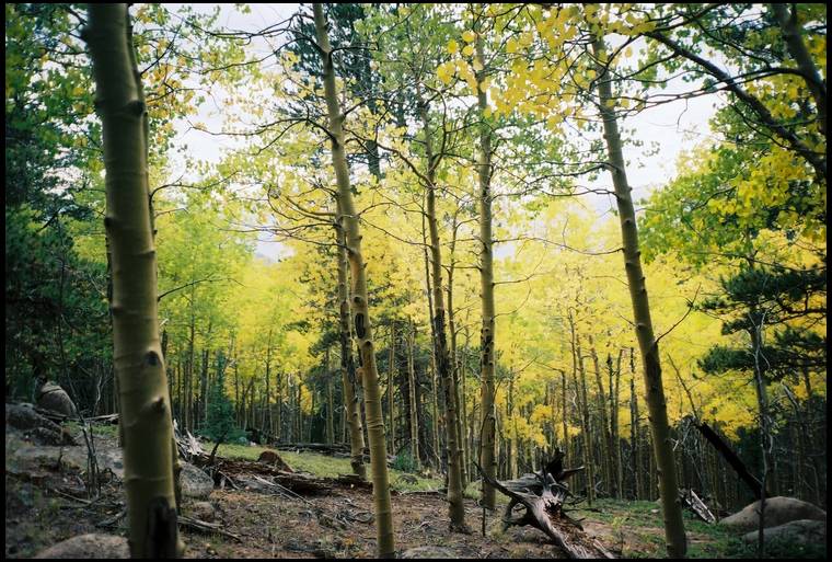
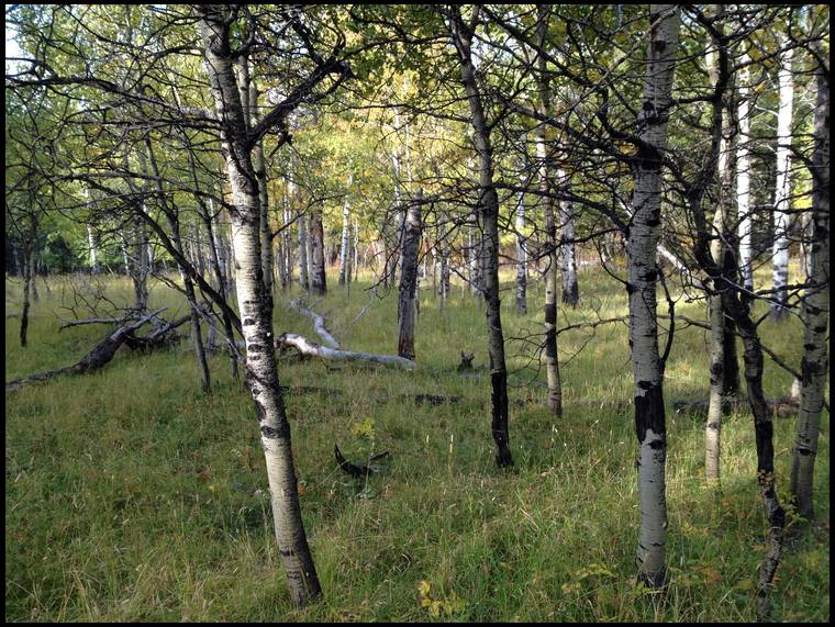
Orionsbrother, your picture in the aspens... I can smell the damp grass, hear the aspen leaves quaking in the breeze and feel the thermals coming down the slope... Wait... I think I just smelled elk. We call it "smelk" ;^)
Thanks Pasquinell, we'll see what we can do with another elk thread.


But the weather is changing. I should be able to get some outdoor shooting in soon and I'm starting the break in process on a new pair of boots.


Here is an Idaho ooops, we won't name any names though :)


Going to MT for a mule deer hunt and might buy an elk tag for there if I do not draw in AZ. The place has a good mixture of elk and deer so a cow might go down as well.


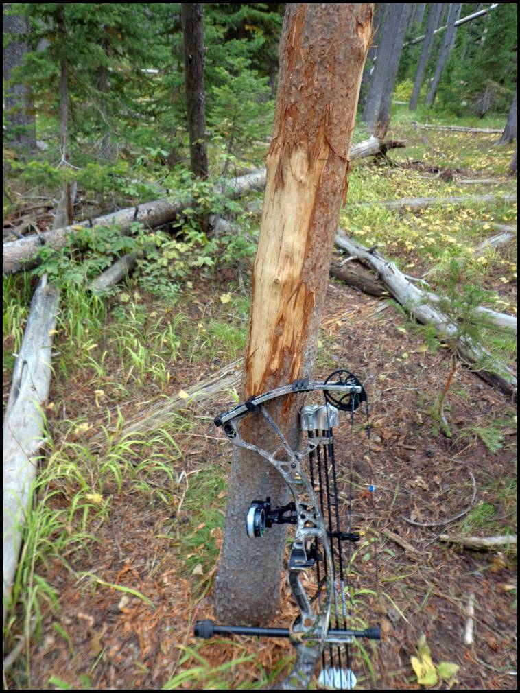
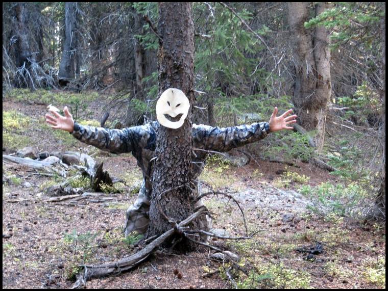
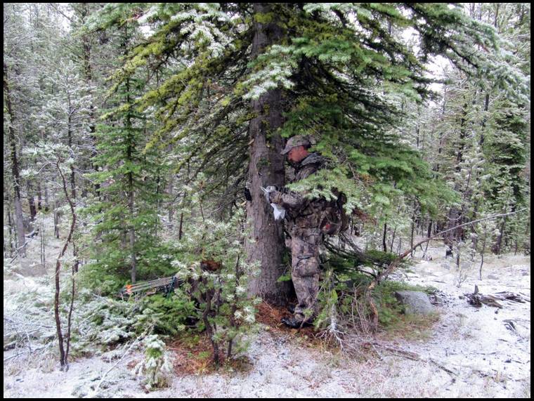
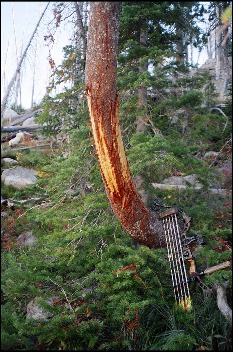
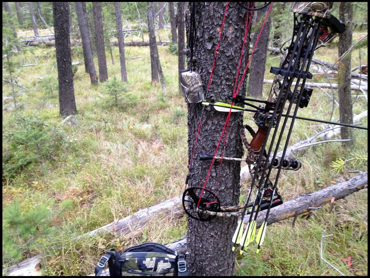
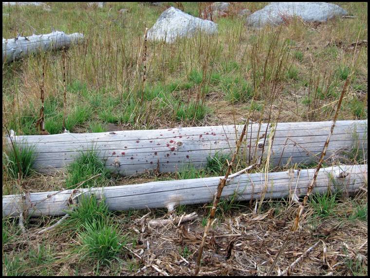
Looks like whoever it was center-punched that tree!


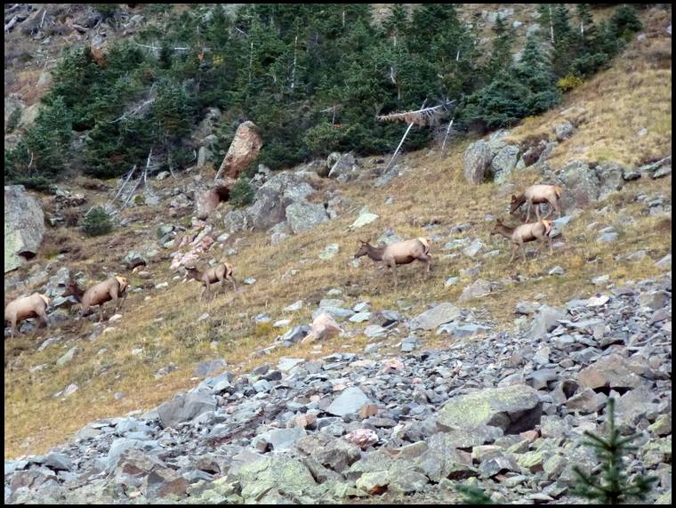

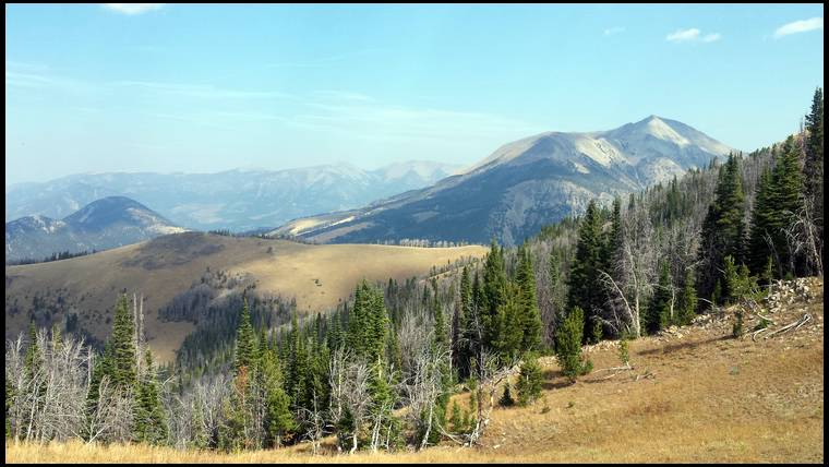
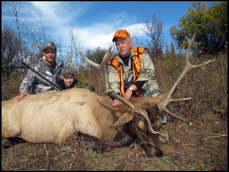
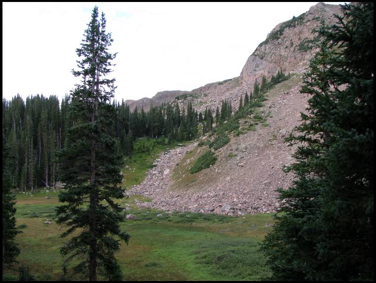
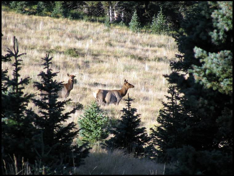
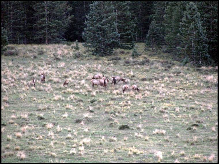
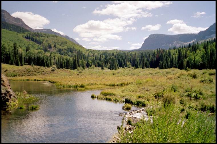
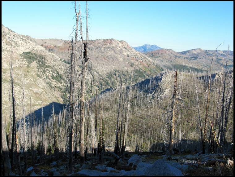
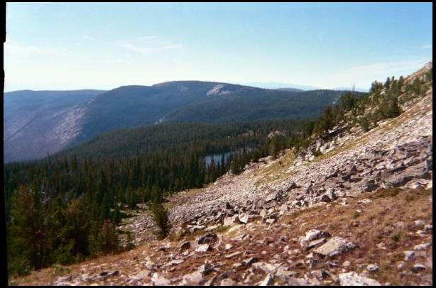
This small herd had a couple bulls in it and I ended up chasing them up the mountain all morning which resulted in the close call with the 350" bull mentioned in my last post.
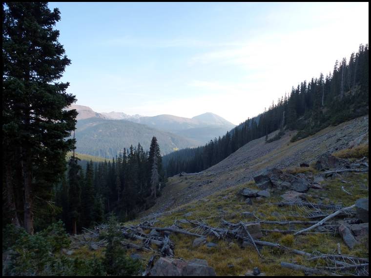

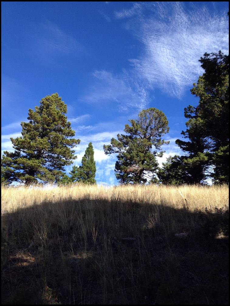
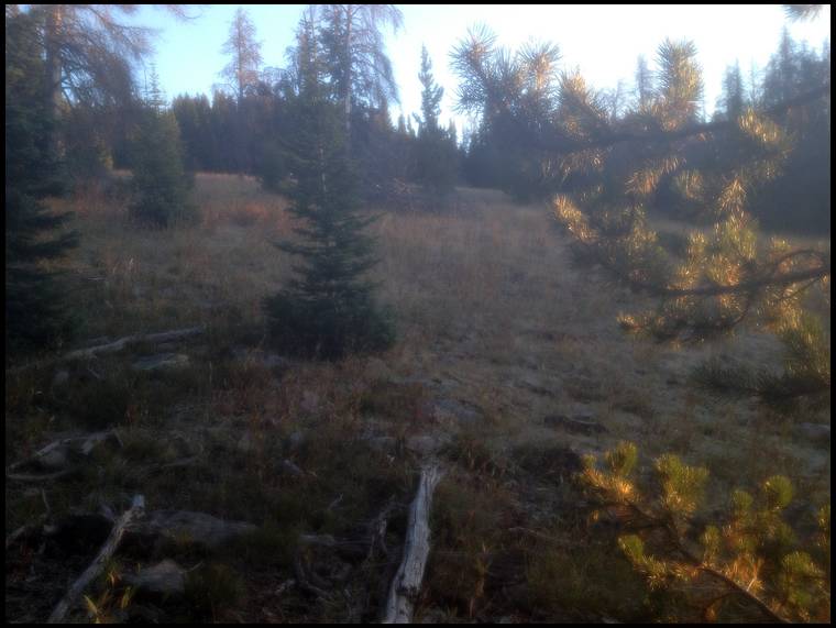
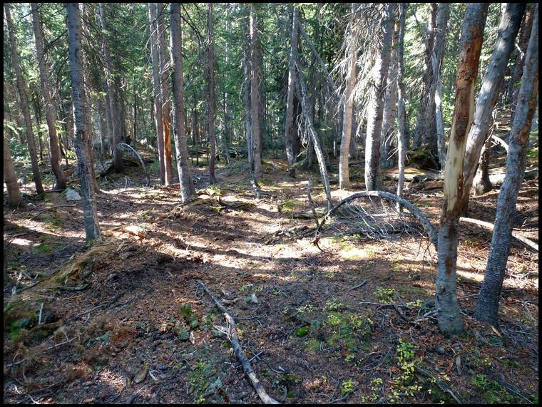
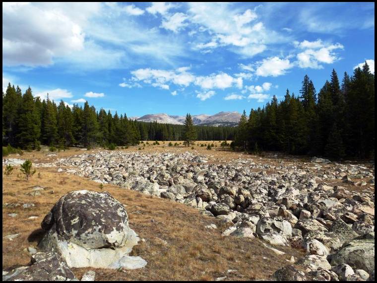
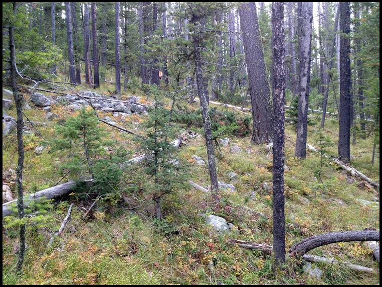
Here's the steep mountain I chased the herd up. To the right in the photo. The dark timber to the left had some of the heaviest bedding sign I've ever seen.


Remember, you don't get to add hunts you've always wanted to do at the end of your life.


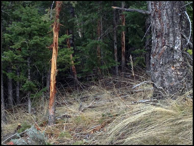
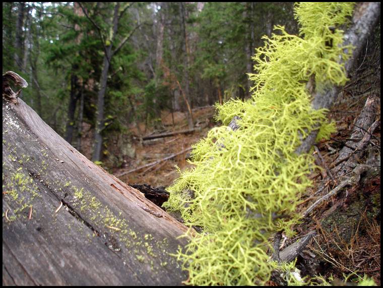
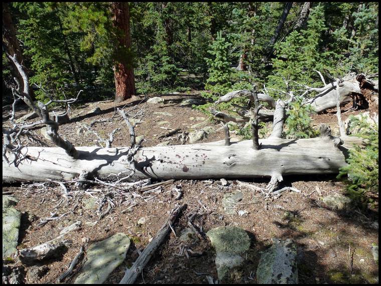
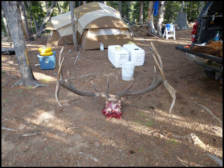
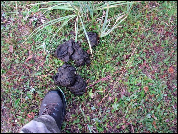
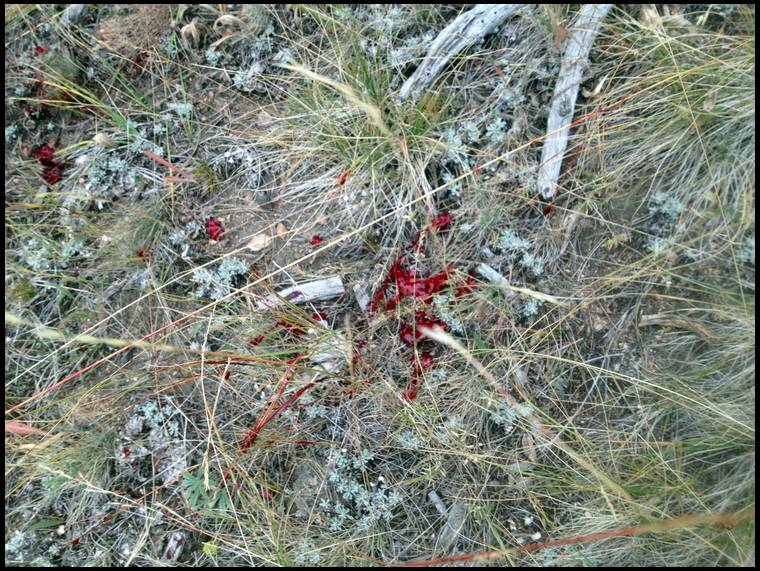
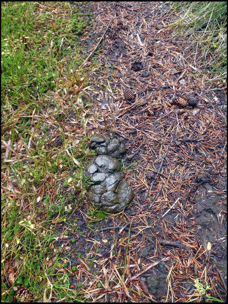
This is the kind of thing you like to find on an elk hunt!

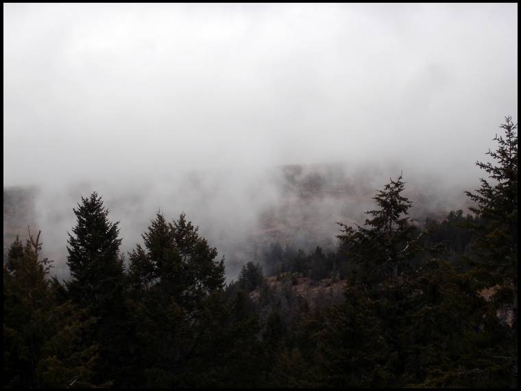


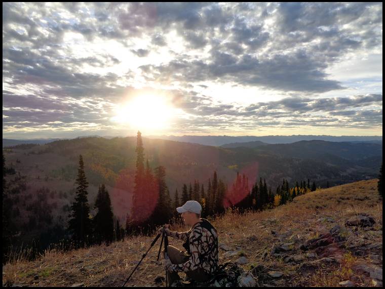
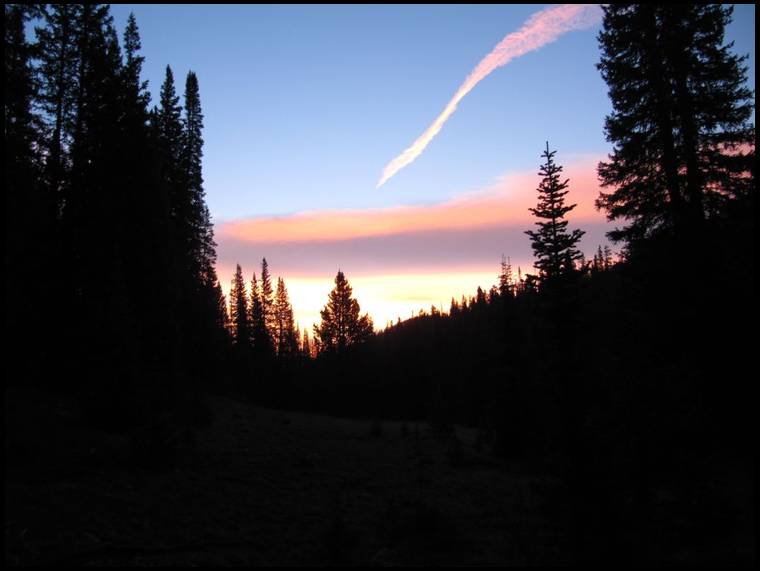
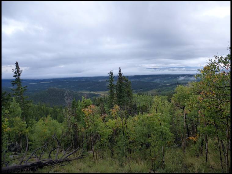
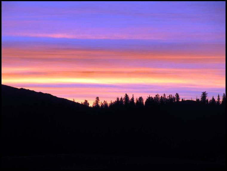
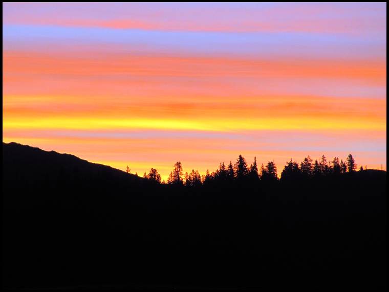
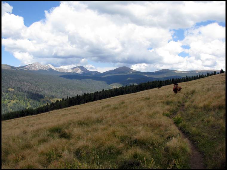
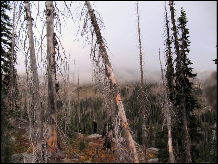
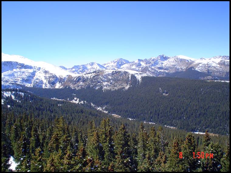
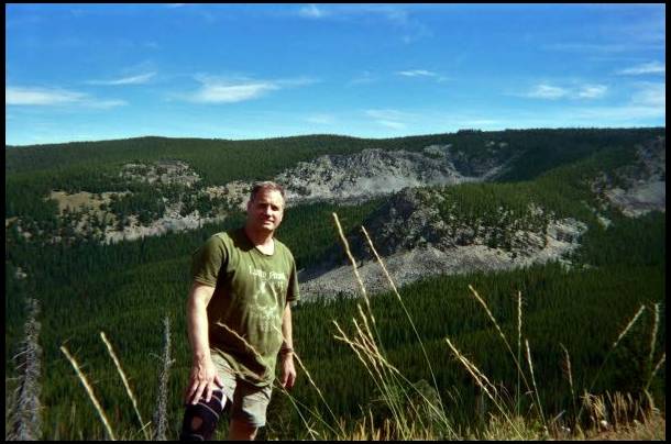
It was thundering below us in this pic
I appreciate their input, pictures and threads very much.
Mike and Les, what have you guys been using for knives? I have a Havalon in my kill kit, but I like to have a lightweight fixed blade as well. I was gifted a Kestrel this past year and was somewhat excited, but after using it on a couple of deer, I'm not so happy with the way it holds an edge. I think that I'm going back to carrying a small fillet knife with only the inner black plastic part of the sheath.
Elkaddict's Link
I like my Havalon, but prefer a longer blade for removing the backstraps and deboning front shoulders etc. And I like having a second knife as insurance.


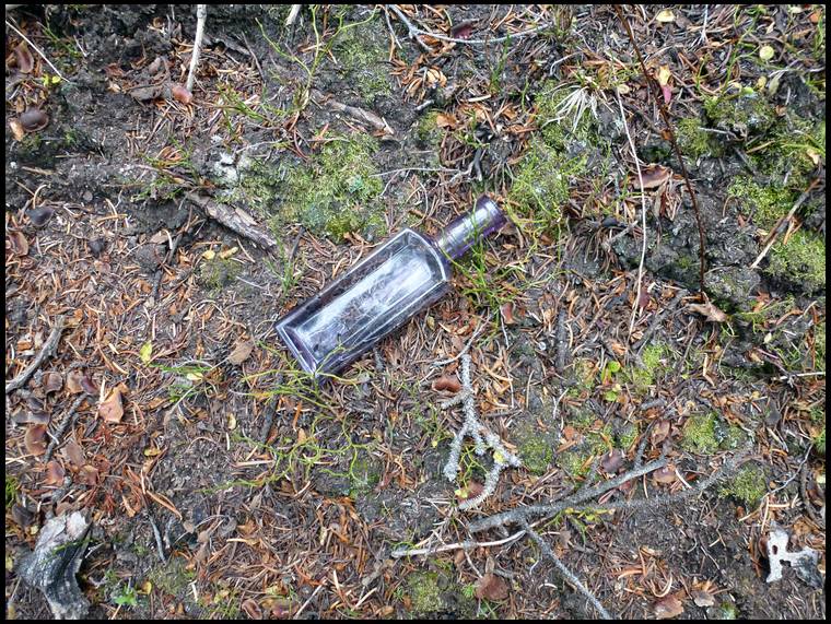

One day I was climbing one of those hills that you practically have to pull yourself up with your hands and I found this antique purple bottle. I thought it was pretty cool so I wrapped it in paper towel and put it in a ziplock bag to protect it. I set it on a stump next to my tent in our remote spike camp and planned to bring it home with me but it disappeared over night. I searched all around camp to no avail. It's still a mystery...


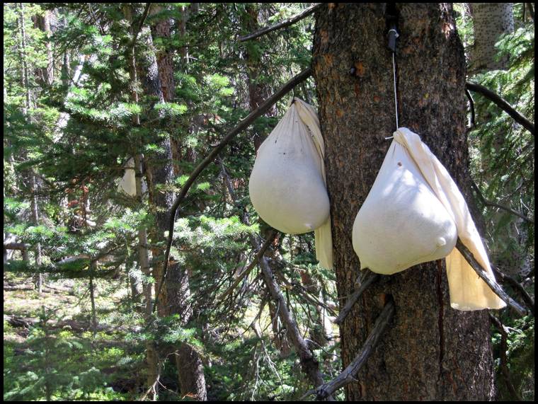
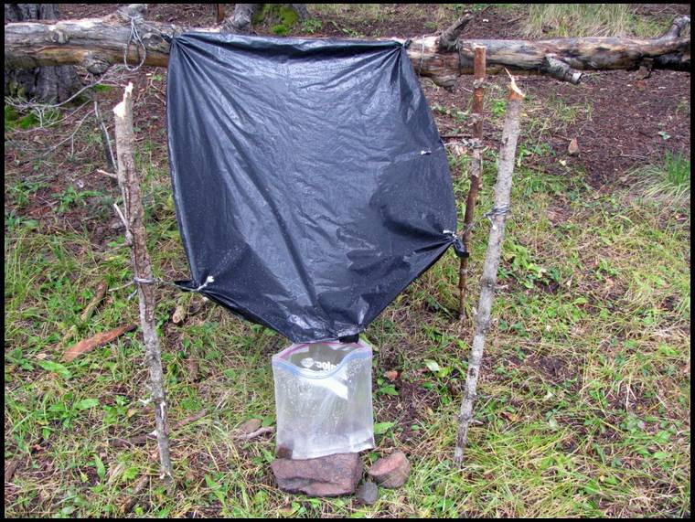
We don't always go easy in the wilderness, but when we do....


In regard to knives, I don’t have anything fancy. I discovered about 10 years ago that a hook-blade utility knife (the kind used for tile) works wonders on elk hide. Elk hide is much thicker than deer hide and it’s often extremely dirty from the bulls wallowing in the mud. The hide on the back of the neck of my biggest bull was amazingly a full inch thick! A hook-blade utility knife zips right through (most) elk hide and saves the edge on your other knife for cutting meat.
I now carry a small aluminum folding Gerber utility knife (similar to Les’s) with hook-blades. In addition to the utility knife I carry a small RMEF edition fixed blade Buck knife with about a 3” blade and a blaze orange rubber handle. I also carry a very small caping knife that is very much like a scalpel and came as part of a 2-part set that I got when I joined RMEF several years ago.
The utility knife and the small fixed blade is all I’ve ever needed to break down and debone a bull. The small caping knife weighs next to nothing and is very useful for caping a bull up on the mountain.
I’m not saying that my knife system is the best but it works for me. I don’t have any personal experience with the havalon but I know others speak highly of them. Les has one but I haven’t seen him use it much. Regardless of what knife you choose I highly recommend also throwing a lightweight utility knife with hook-blades in your pack.


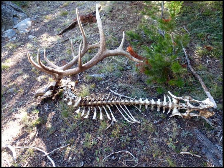

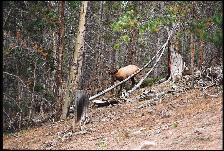
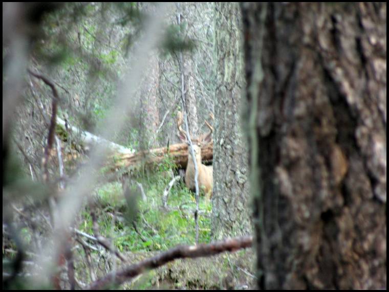
Sometimes you find them...


Yeah, I always keep my camera at the ready either in a pocket or in an accessible pocket on the hip belt of my pack. There have been times when I didn’t take enough photos and I regretted it.
Grunter,
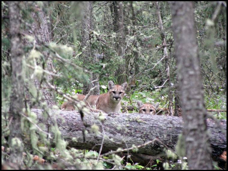
The cats were 22 yards away and yes it was pretty freaky. I was torn between fright and fascination. I stood up on a log and made myself “big” so they would know that I wasn’t an elk. I nocked an arrow and had my release on the string. I knew running would be futile if they decided to attack. After 30 seconds or so their body language appeared to indicate that they weren’t going to attack so I pulled my camera out of my pocket with my release hand and snapped some photos. After a minute or so they turned and left. A chill went up my spine when I thought about would could have happened if I hadn’t noticed them and stood up.
Les also has a mountain lion story from that same area but I’ll let him chime in if he wants to.

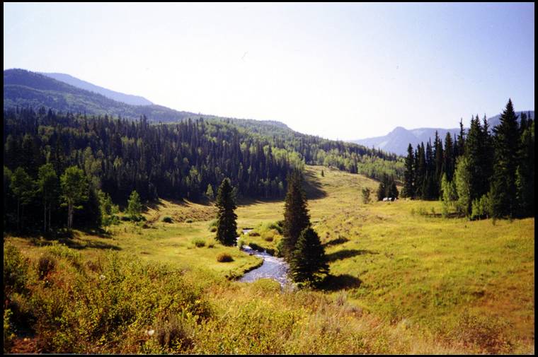
They were beginning to move and I knew it would be too late if I tried to circle around and get into the timber on the other side of them and the wind wasn’t favorable for that anyway. I made some pleading cow in heat calls and one of the satellite bulls came out of the timber and started heading my way. When the herd bull saw him he put the chase on him and actually chased him straight toward me.
I was hoping he would keep coming but the herd bull turned back to his cows at about 80 yards from me. The satellite bull, a decent 4x5 walked past me at 25 yards in the wide open. I came to full draw and stopped him with a cow call but decided to give him a pass. It was early morning and the herd bull and the other satellite bull were still bugling. Once the herd started moving I tried to follow but they headed down the drainage and I couldn’t keep up. Also the thermals were still going down and if I tried to follow I would be busted anyway. I guess they didn’t realize that they’re supposed to be going up the mountain in the morning…

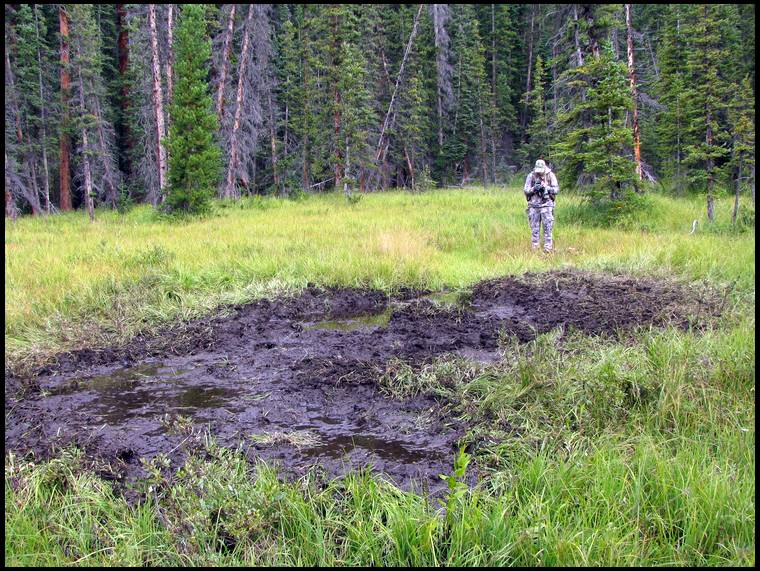
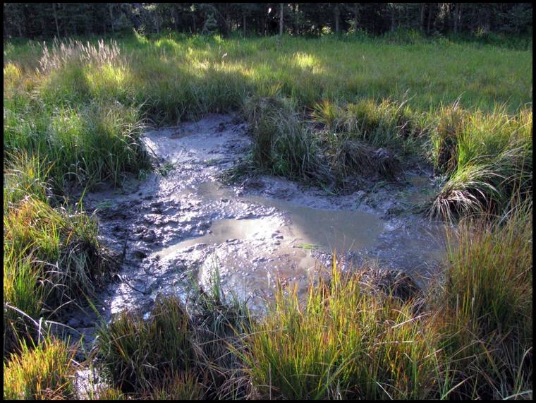
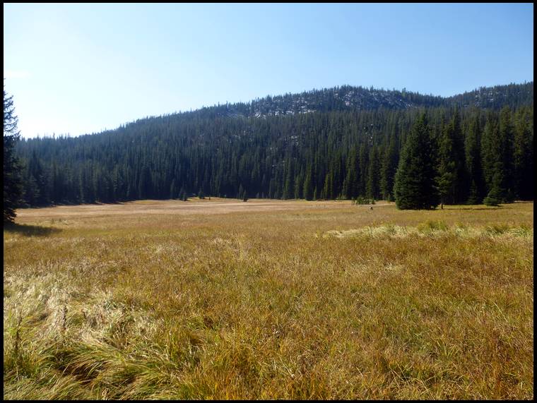
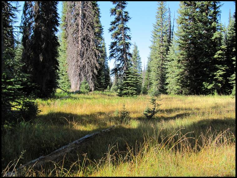
All of a sudden a scraggly little raghorn 4x4 practically ran out of the timber into the meadow and headed straight to the wallow. It was like a little kid running for a candy dish. He dove right in and went to town. If you’ve never watched a bull wallow, it’s very entertaining to watch. It seems almost orgasmic for them. He rolled his eyes back like he was possessed and rolled around throwing mud everywhere. At times only his head was sticking out of the mud. I watched him for at least 5 minutes still hoping a herd bull would show himself and the sound of the little bull wallowing would bring him in. While the bull was wallowing the cows continued to mill around and some were within 20 yards and starting to work their way downwind of me. I had ranged the little bull several times at 42 yards as he wallowed. Eventually one of the cows seemed to catch my scent and got nervous. She turned and trotted into the timber. The rest of the cows sensed her nervousness and followed suit.
As I watched the little bull wallow I decided I would shoot him if he gave me a shot. He was much smaller than the bull I had passed up earlier that morning but I had also drawn a tag for another state and I was a little antsy to go there. Killing this bull now would give me time to hunt the other state.
All of a sudden the little bull stopped wallowing and looked around and it was like he was thinking “hey, where did everybody go?” He pulled himself out of the wallow and stood there perfectly broadside looking around. Most of my shots at bulls happen pretty fast without a lot of time to think; this was the most wide open, relaxed shot I had ever taken. It was really cool to watch the arrow flight through the meadow and the bright yellow fletch pass through the black muddy bull. It was a 42 yard shot and he ran 40 yards and tipped over.

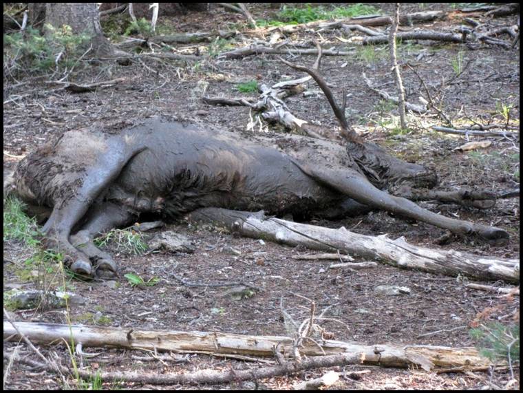

I'll definitely think twice before shooting a bull fresh out of a wallow again; he was a mess!


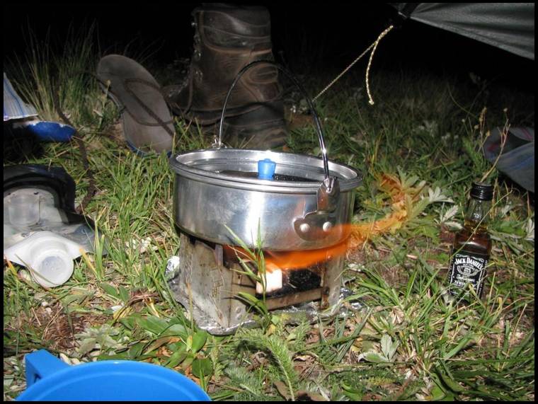

That way you'll have more money for big bottles of Jack!


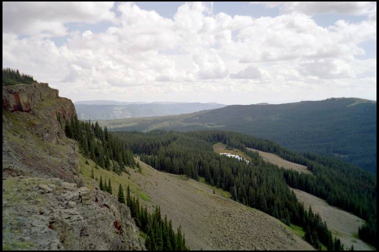


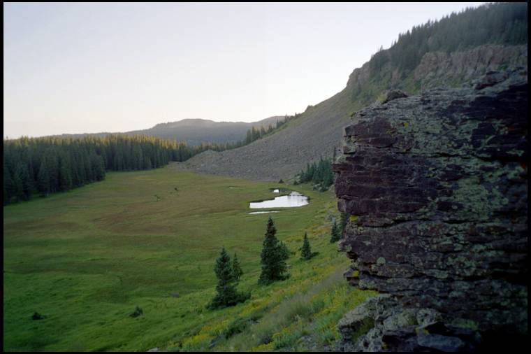


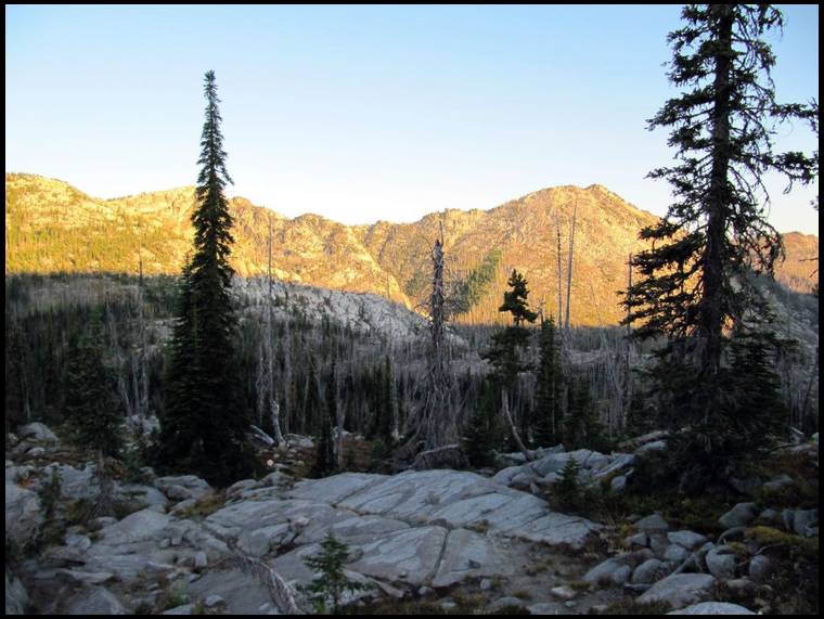
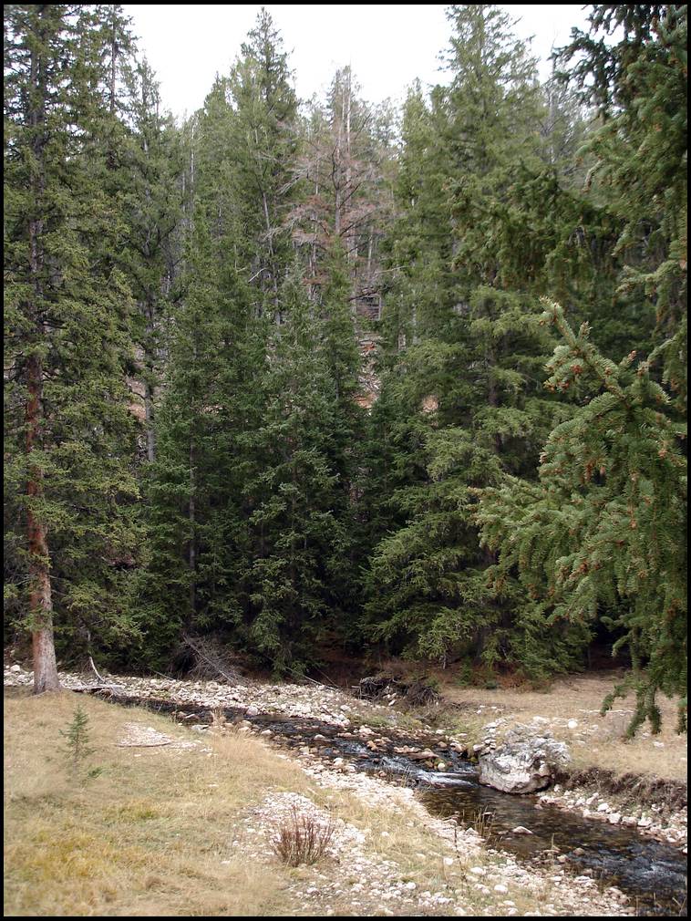
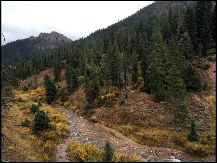
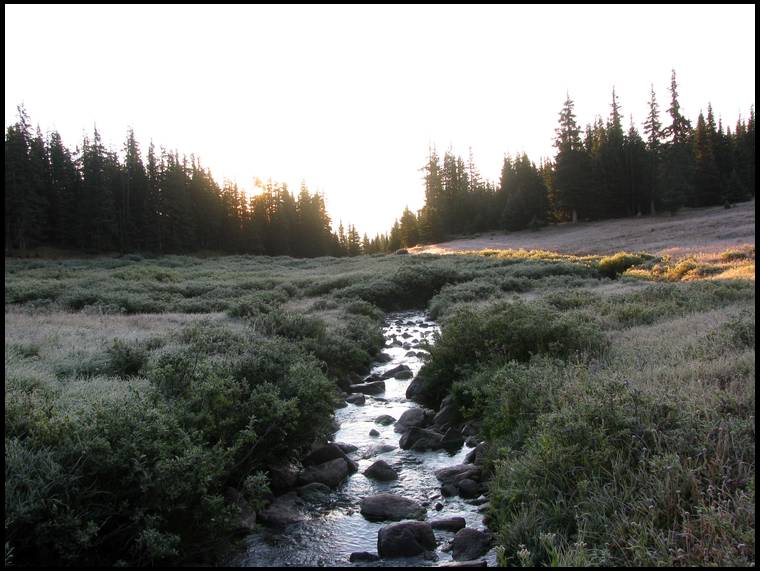
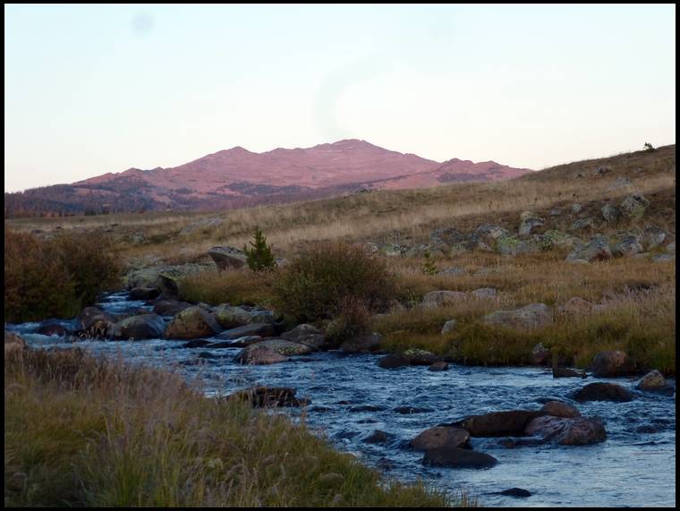
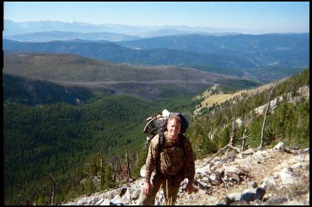
Sometimes you get yourself into situations that truly can be dangerous, especially when you're solo. This was one of them, my climb out was basically rock climbing with no ropes or rock climbing equipment. I climbed very slowly and cautiously with my daypack and bow on my back.
This photo is from the top looking down after I climbed to the top. You can see the stream at the bottom which looks tiny but it's actually a good sized stream. The photo doesn't really do it justice. This was one of those days where I collapsed from exhaustion when I finally got back to my tent that night.

with my wifes blessing, I am leaving for out west on August 20th,,,, I am going to try and kill and elk and if I am lucky, an antelope either in Wy or NW SD....
I swear, I am going to learn how to put our pictures... I am going solo, because I do not want to be on anothers schedule, and I am in no rush, and I will shoot a cow or whatever is legal....
I am going for a month...... life is short, go hunt
would have gone last year,, but my signals were mixed up with trapper, who I did not hear back from, but that have might have been my fault since I was all over the place....
have all the equipment, looking forward to it, might even haul out my tent camper but not sure yet.....
I like the idea, of doing what I want, when I want,,, hunt for 3 days, sleep for 2 days, who cares ha ha....
no time schuedule.....
Does everyone carry a gps with extra batteries? And how do you tell property boundaries? Do you get a map for gps that shows exactly?
Let's keep this elk thread going till Sept! Any info on elk or wilderness living I want to hear it. I don't care if it's how to take a dump in the backwoods or the best way to start a fire back there. So much info that newbies like myself need to learn. Thanks everyone for their input. Knowledge is power. And.....more pics :)
Sometime the next morning I could see a little puff of smoke coming from Mike's right rear wheel on the trailer.
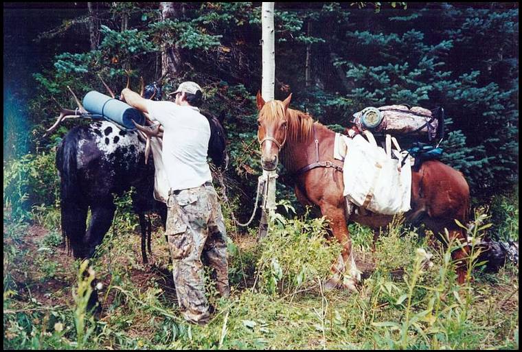

I have rented pack horses once and that was on my very first elk hunt. After I got a bull, my buddy hiked out and called Sombrero Ranch while I was finishing packing the meat to our spike camp. Sombrero delivered the horses to the trailhead and my buddy Clark returned the next day riding Whiskey and leading Cracker Jack.
We loaded the meat and the rest of our camp onto the horses and walked them out. Sombrero picked the horses up at the trailhead and I think it only cost us $100 per horse.
It was a good deal and it went off without a hitch. I wouldn't hesitate to do that again if it was an option.
I agree with Elkaddict though in regard to renting horses for the actual hunt. I want to spend my time hunting rather than taking care of horses. Maybe if I was more experienced with horses I would feel differently but I'm not...
Twice I have also paid an outfitter to pack an elk out for me but that usually isn't an option where we/I hunt.
On my second successful elk hunt I killed a cow. We were planning to hike out and call Sombrero to rent a horse to pack the meat out but figured we might as well pack some of the meat out with us since we were hiking out anyway. After loading about half of the meat into our packs it seemed ridiculous to me to rent a horse to pack out what was left. Me and my buddy Craig had a little debate about it and decided to pack out all the meat in one trip. We did it but it was pretty brutal and Craig hasn't hunted with me since... :^)
My pack was ready to go. Plan was to get to the trailhead and get started in on the 6+ mile hike into the wilderness to a semi pre-determined camping area.
With the trailer issues, and a slower than snails pace ride in for the last few miles I only had about 2 hours before dark. Not enough time to get in 6 miles before dark, and I wasn't really comfortable hiking 3-4 miles in the dark in unfamiliar territory.
I decided to cook some supper at the truck, check everything over, get a good night's sleep, and head out before sun up the following morning.
Last year was the first time we carried bear spray and that's because we were in an area in Montana where grizzly bears were a remote possibility. After a couple days we both left the spray in the tent.
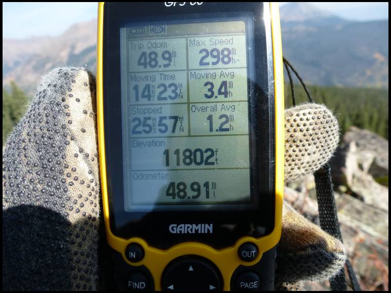
Yes we always carry a GPS with extra batteries and sometimes and extra GPS.
So far I have always hunted in large tracts of National Forest and/or designated Wilderness Areas so it's all public land with no boundaries of private land anywhere close.
We do always carry detailed topo maps that we rely on heavily. I'm a land surveyor and I believe that my ability to understand maps has played a big role in the success I've had, especially in new areas that I have never set foot in before.
The only time I can ever remember a boundary coming into play (other than hunting unit boundaries) is when we were in Wyoming where non-residents are not allowed to hunt designated Wilderness Areas without a guide. In that case my map had the boundary on it and we were able to plot our position on the map to know where we were. But ever quicker than that, Elkaddict has a mapping chip in his GPS and he was able to determine instantly where the Wilderness Boundary was.
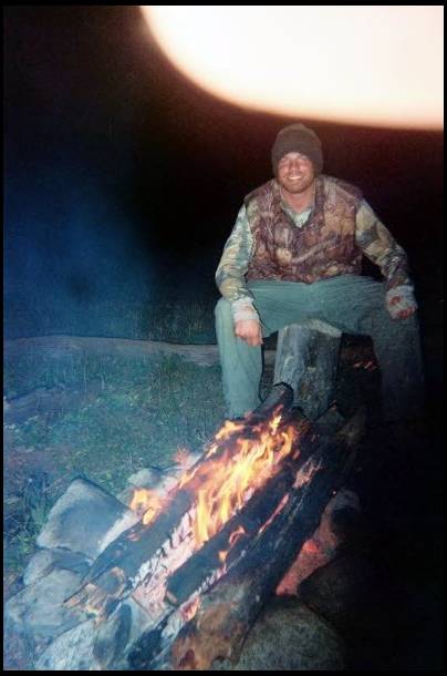
I have only had campfires twice in 17 years of hunting and both times were because we needed to dry soaking wet clothes or we were going to be in bad shape.
I believe in keeping as low of a profile as possible when elk hunting and I feel that campfire smoke may give you away. I have a pretty sensitive nose and I can always tell when there is another hunter sharing the drainage with me/us if they have a campfire. If I can smell it I guarantee you that the elk can too. It may not matter but I don't think it's worth the risk.
I have some anecdotal evidence where I was on a hunt and was having a great time and getting into elk everyday in the same drainage. One day the elk were suddenly gone. On my way back to camp that evening I smelled campfire smoke wafting down the drainage. I eventually saw the glow of the fire along the side of the canyon. So was it the smoke that drove the elk out? Or the presence of the other hunter? Or something else? I'll never know but the elk were there for several days while I kept a low profile. After discovering the other guys camp I played a hunch and climbed up over the mountain ridge into the next drainage and found elk again and resumed an amazing hunt.
Cheesehead Mike's Link
I've attached a link to Corey Jacobsen's video on the gutless method.
Not knowing any better, I gutted out my first elk and it just makes more work and mess for you to deal with.
I headed out by headlamp roughly 45 minutes before light. I had never been in this state, much less the unit so the going was fairly slow until light. When I reached a fork in the trail I decided to go right, instead of left. This was a last minute decision. I had planned on going left and getting to my determined location ASAP. There was however a bull bugling quite a distance from me on this side of the drainage. I figured by looking at the map I could bushwhack across country for a couple miles and get back on track later in the day.
On this trip I was going to learn a lot about the the importance of how to read a map, and then actually doing it.... :)
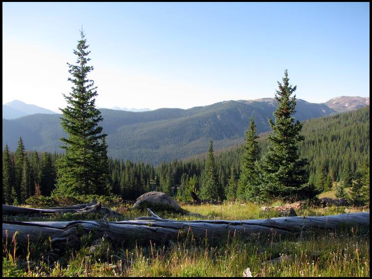
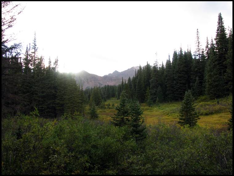
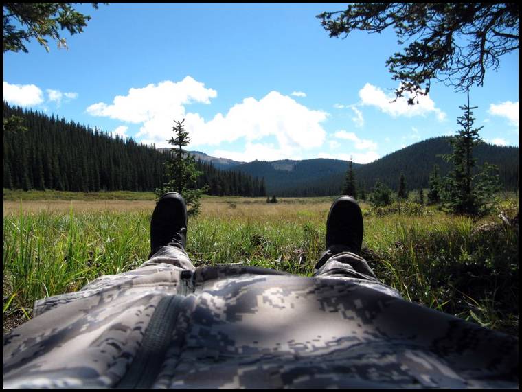
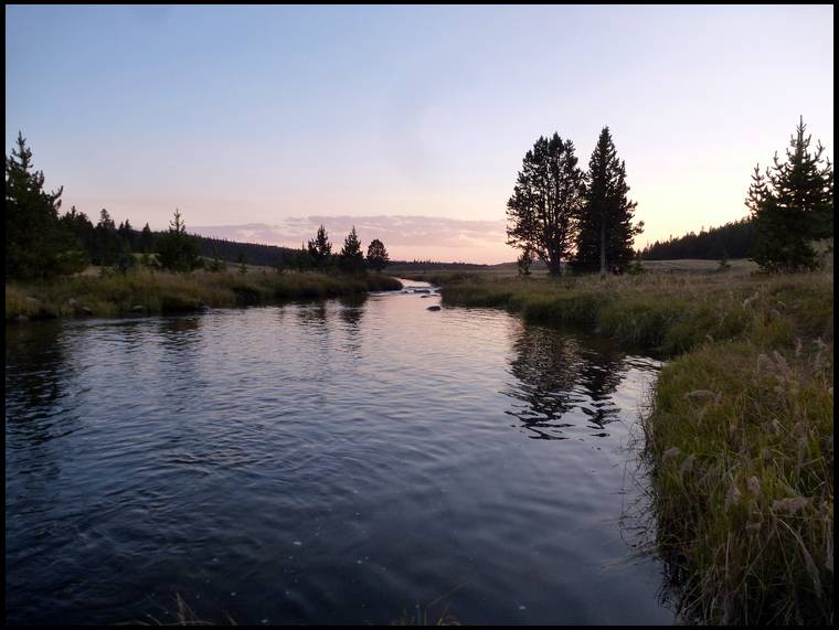
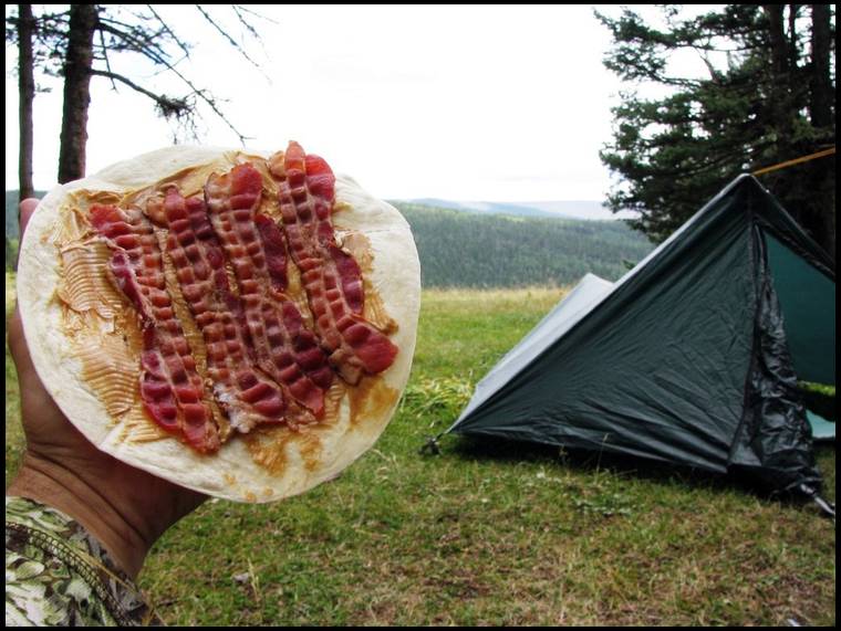
It was sunny and 70°. I'll never forget it. My first solo elk hunt. I was tired, but seriously loving what was unfolding.
First order was food. PBBH Tortilla. Then it was get tent, pad, sleeping bag set up. I had to take a little break to take a picture for some horse riders going by.
Once that was all taken care of I knew I needed to get water, and wanted to do a little scouting.
I had marked 4-5 spots on my GPS/map to look for water. I finally found some good clean, flowing water about two hours before dark. I loaded up everything I had.
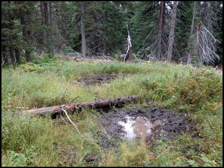
In the process I had found some good sign and logged it. I also wasn't far from a wallow. When I got there the wallow was clean, but it had been being used for drinking, and one not to far away had been rolled in a little.
Referencing tips in a question above......the most important thing to elk hunting is wind direction....bar none. I would say more elk have been saved because of wind then every other reason combined.
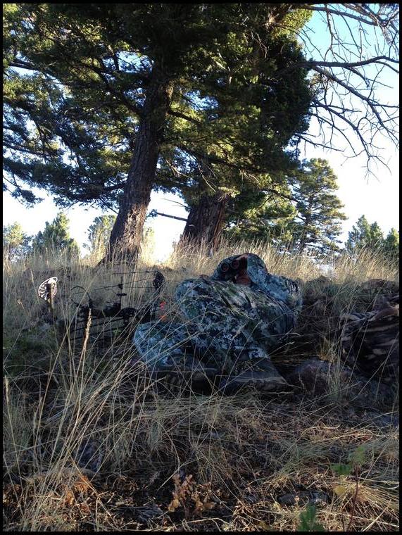
That said when I was deciding where to sit back and relax, I realized my windicator was gone. WTF!! So here I am 25 yards from a water hole tossing up dry dirt in the air to see what was happening....lol. I wasn't comfortable with this and I reasoned it logically could have fallen out of my pocket a few hundred yards back when I filtered water. I left everything but bow and GPS and headed back, sure enough it fell out right there. 20 minutes later I was setup just off the water. Really just relaxing and soaking it all in.
With about 75 minutes of light left, it was still silent. Enough of that, so I let out a bugle with my Imperial reed and in about 5 seconds got a response, and then another!!!!
These elk were already below me though, so I wasn't too excited. I knew they were to far away to catch up to as they were heading down the mountain.
Their next response to my bugle and they had cut the distance by a couple hundred yards....time to re position and get some shooting lanes and thermals in my favor.
Tip #2, just because it's the norm, or your read it on the internet thousands of times, don't take it for gospel. These animals only have one agenda, that is to stay alive. They don't always do what they are "supposed" to.
Within a few bugles and a matter of minutes this was getting real, FAST. I could see the antlers of this bull at about 100 yards, angling right towards me...ruh roh raggie...I was set up 2 yards off the trail he was walking up, right to the water....
For whatever random reason he turned off that trail and was going straight perpendicular to me. I ranged him at 35 yards, but he needed to clear about 15 more yards until I had a big opening. Then I spotted a second bull coming up the trail. He was still coming.
I could see this was going to totally be a timing issue.
Left and right was beautiful, but I lost the arrow in the grass and couldn't tell where the trajectory took it. Both bulls bounded off. I could hear the second bull for about 10 seconds longer than the bull I had shot it. Was he down already? It was much quieter vegetation in that area so maybe he was just out of hearing already? Or had he stopped?
And I have an amazing ability to position my windicator bottle perfectly for a raindrop to hit the spout and goo it up.
I now have two with me on every day hunt and at least 4 in my pack for pack in hunts.
Tip #3 ^^^^^^
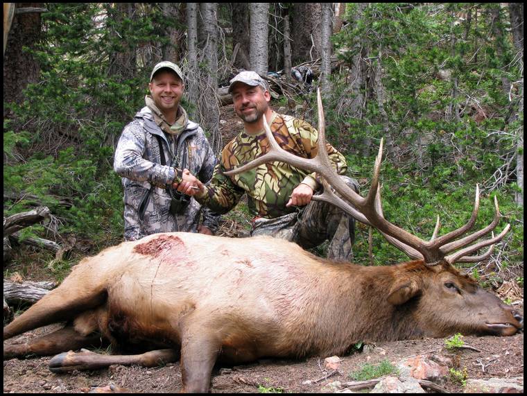
Sure enough here was my 5x5, 75 yards from where I had hit him. Perfect double lung.


Honestly what was in my mind was, if I hang this meat up, I just have to take it back down and reload before starting out in 6 hours. Lazy right? :)
I decided screw it. GPS, map, extra batteries, Glock, and water were added to my pack. I saddled up and headed to the truck....at 11 pm.
Somewhere around 1 am I see a campfire ahead of me on the left side of the trail up a hundred yards or so. As I'm very focused with my head down on the skinny pack trail I stop again to look for the campfire. Nothing. WTF, a camfire just doesn't magically go out in 3 minutes. The main reason I carried the Glock was for 2 legged trouble, and now this had me a little on edge. What elk hunters would be around a fire at 1 am anyways?
If it's ok to add to your tip #3, I also carry a small pill bottle of old school milkweed fluff that I like to use in more open areas because I can watch the wind variations and thermals further.
Also, along the line of the waterhole windicator, if you strap your bow onto your backpack for the hike in or out and you have a detachable quiver, tie a small leash of triptease to it. Climbing through bad blowdowns, you can hit the quiver knocking it part way loose and it can drop off later down the trail, resulting in a lot of swearing inside your head.
Ended up getting the elk out just before dark that night. Then I jumped in the truck and started driving. I left Mike a message and said I was driving and he had a couple hours to LMK if he wanted someone to hunt with for a couple day, otherwise I was headed home to fill a bear tag. He called back (lucky he had cell service) just before I had to make the decision to turn towards him or home. We had a fun hunt for about 4-5 more days before I headed home to take care of my meat and hunt bear.
Of course, it's not so funny that while tip-toeing through the dark, stepping over a log, there've been several times I've almost chit myself when a grouse exploded from under my foot. And the last time I checked, a grouse never ate anyone.
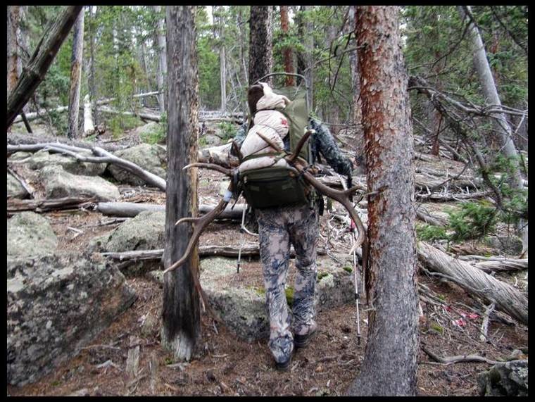
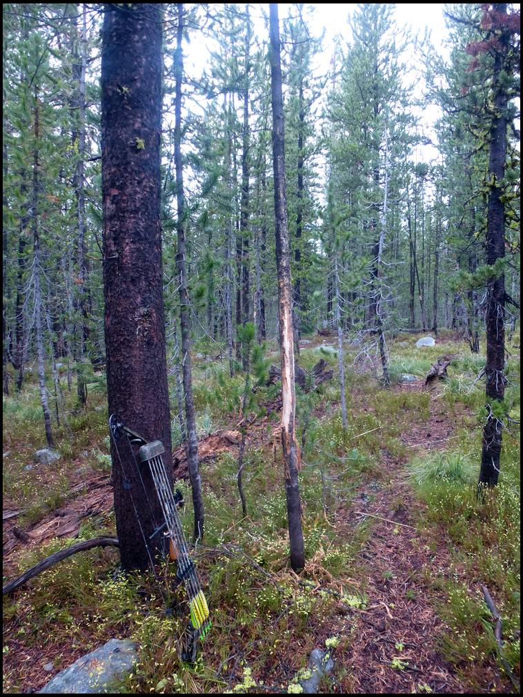
The bull in this last story was around a 1 mile or so trek back to my camp, maybe a little more. It was uphill, through nasty deadfall. Plain and simple, heck of a workout. If I would have looked at my map, I would have realized I could have taken it downhill 200 yards right to a nice little pack trail......that went back to the meadow I was camped in.....oops.
It's a wonder Mike and I kill anything anymore. Now at about any point it seems like one of us is looking at a map, taking a picture, or eating :)
You can print topos off of your computer, sizing them as you wish and sandwich the map between clear Contact Paper. They're then durable, still foldable, pretty much weatherproof and you can write on them with a ballpoint pen.
I use a highlighter to label them and mark North and a blue marker to mark known water before putting them in the Contact Paper.
The topo maps on the little GPS screen are nice but I'm an old school paper map and compass guy. I prefer a large paper map when studying an area to see the big picture which helps predict elk locations and movement patterns.
Taking time to study your maps can save you a lot of effort. I had killed a bull the year before in almost the exact same location as the one Elkaddict killed in the story he just told. However, instead of packing it up the mountain through all of the blow downs and thick timber, I stayed on the bench and followed the contour to the nice pack trail and then took the trail up the mountain to camp. When Elkaddict told me that he packed his bull up the mountain through all the crap I told him how I did it the year before. There was no need to say anymore, that won't happen again!
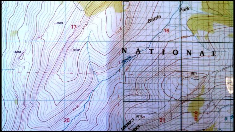
When planning on going from one point to another you should always take into account the number of contour lines you will be crossing and how close together they are; obviously close together/tightly spaced contour lines equals steep country.
For instance if you are currently at the 11,200 foot contour and you want to get to the 11,200 foot contour on the other side of the drainage and the contour at the bottom of the drainage near the stream is 10,000 feet that means to walk the straight line you would have to descend 1,200 feet and then climb 1,200 feet to reach the point you wanted to be at on the other side.
I have a rule I try to live by in the mountains and that is: “Never give up elevation unless absolutely necessary” because every foot of elevation that you give up you will most likely have to work hard to gain back by climbing.
Think of contour lines on a map as “lines that connect points of equal elevation”. Therefore if you are standing on a contour line and you can follow that contour line to your destination you’ll not have to descend or climb because every point along that line that you are following is at the same elevation. If you look at a topo map you’ll see that all contour lines bend and point upstream in a drainage. The contour lines then cross the stream and follow the side of the mountain and go the opposite direction on the other side of the canyon/drainage. If you’re standing facing a drainage/canyon and to your right is uphill/upstream, rather than going in a straight line to your destination it will be much less work and often faster if you follow the contour to your right and stay on the same elevation until you cross the stream and then continue to follow the contour until you get to your destination on the other side.
You can also compromise on this tactic by climbing or descending a little as you follow the contour. This will cut off a little of the distance that you have to travel but will result in descending and climbing a little more than if you strictly followed the contour.
Of course there are times when you don't have time for following a contour such as when you are chasing a hot bull and sometimes you just have to bite the bullet and dive into the drainage and then charge up the other side. But as a rule, if you try to minimize how many contour lines you cross in your normal daily travels you will find out that you are a lot less tired at the end of the day and you'll have more energy when it comes time to pack out elk meat.


My maps have a UTM coordinate grid and the coordinate display on my GPS is also set accordingly. UTM is much easier to work with than Latitude and Longitude because you are measuring in meters which relates to an exact ground measurement rather than degrees, minutes and seconds which requires some mathematical gymnastics to convert to actual ground measurements.
Whatever type of topo map you use, you should be sure it has UTM grid lines or UTM coordinate grid tics along the edges. Some of the newer USGS topo maps have UTM grid lines on them and the older versions have tic marks along the edges allowing you to draw your own grid lines on the map.
The grid lines are invaluable for both scaling coordinates off of the map or plotting positions of GPS waypoints on the map.
Let's say for instance you kill a bull and you're not exactly sure where you are. Your GPS will give you UTM coordinates and using the grid lines on the map you can plot your location. Now you can study the map and determine your best route to pack it out, your proximity to pack trails, roads, etc.
Using the method of following contours described in my previous post, so you don't have to change elevation any more than necessary while packing the bull, you could actually plot your course over the map for the easiest route out. You could use the grid lines to determine the coordinates of the points on the map that you want to navigate to on your way out and then you could save those points to a route on your GPS.
Then while packing you don't have to worry about getting lost, ending up in a steep canyon, etc. You can just follow your GPS to each waypoint or follow the route that you saved.
I use this technique all of the time; not just while packing elk meat. Also, you don't need to have your GPS running constantly. I usually get a heading to the next waypoint with my GPS and then shut it off and use my compass to walk the correct bearing while checking my GPS occasionally to adjust my course.
Learning to understand maps, contour lines and the use of coordinates, GPS and compass will go a long way toward improving navigation skills and allowing you to explore off-trail territory with confidence.
I also have a grid that I print on clear transparency film that has 8 dashed grid lines between the 2" UTM grid lines that are on the map. Each dashed grid line equals 100 meters.
That way I can overlay the clear grid on the map and using the grid lines that are spaced every 100 meters I can scale or plot any point to an accuracy of about 10 meters.
If you have a ruler or an engineers or machinist's scale you can measure between the grid lines on any map and estimate the coordinates of any point with fairly decent precision.
I tend to leave my GPS on when heading in or out though, for one reason...blowdowns. If I can pick a way through with sight cues in the light, I want that bread crumb trail when coming back through in the dark from the opposite direction or becoming dimwitted with enough of a load and a long enough day. I don't have one of those headlamps that can direct anti-aircraft fire and create my own daylight.
An old school thing that I suggest for scouting and attack plans is a map measurer. You just roll it along the trail, predicted trail or follow contour lines and it will give you your distance, allowing you more accurate planning.
I don't take it into the field, but it's small and I'll stick it in my "B" "C" and "D" map pack in the truck in case plans change.
If you print off topos and alter their scale, you can use the UTM gridlines and the map measurer to calculate approximate scale for working up distances.
I find it to be an invaluable tool and it's fun to roll around on a map or two on a Friday night in March...daydreaming.
My phone just ran out of charge. I'll post a pic in a few.


Grunter's Link
No one ever has showed me how to read a topo, so I was hoping it would help other people too. I was up till 4am watching topo videos. Cant get enough of this!! Keep it rolling fellas!
My white knuckle drive over wolf creek pass, landed me the sw corner,,,,,,,,
shot a cow elk in 3 days, and realized this was going to be some work.....
tagged and gutted, some locals took pity on me, coming out of a pass, with saddle mules. First they said, why would you ever gut an elk, and they were right, of course, than they took some of my meat for me out, in their paniers, while I humped the rest,,,,,,,
lessons learned - too many bees and flies, when you gut an elk,,,,,, liquid pepper helped a lot,,,,,,, never carry what you do not need, took out too much.....
Air Force taught me all about compass reading and topo maps,,,,,,,,,,


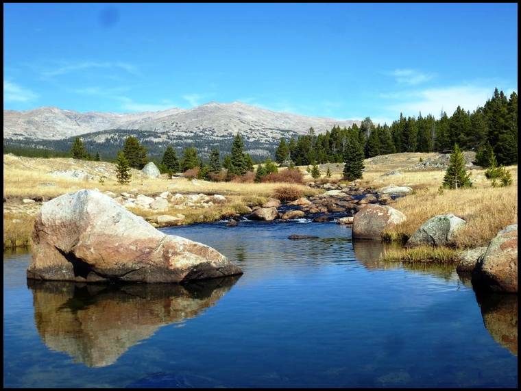
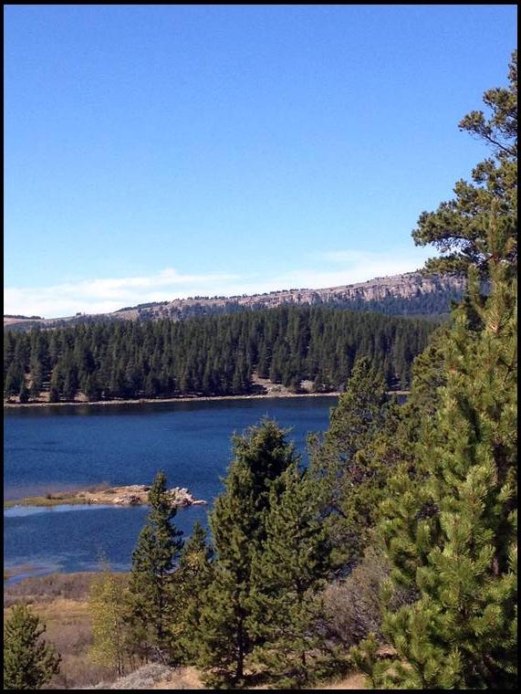
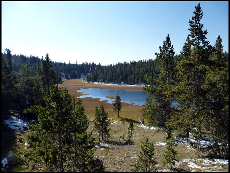
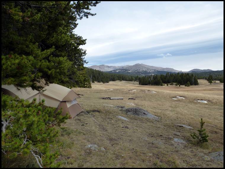
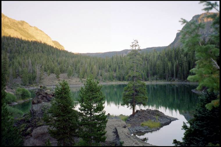
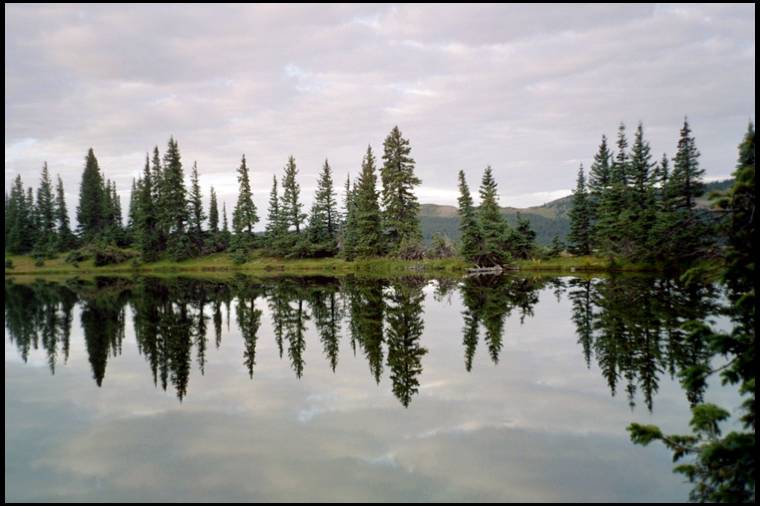
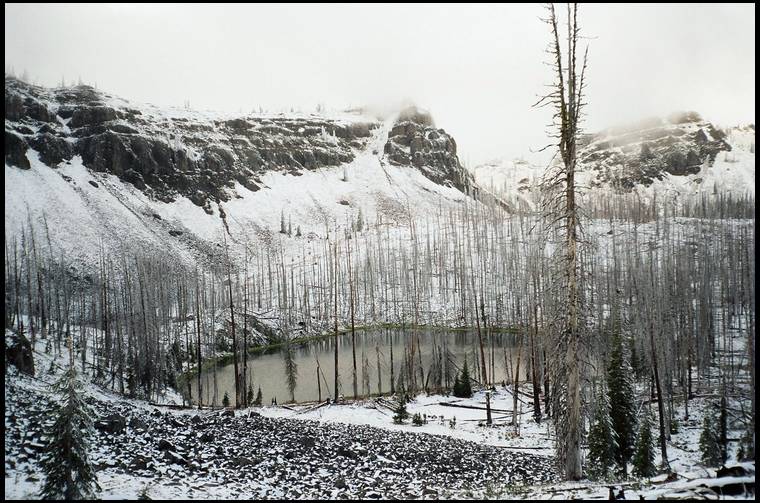
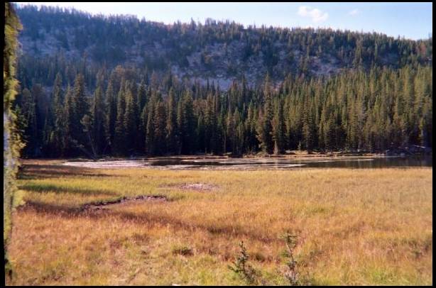
In 2009 I killed a nice bull in Montana and last year we decided to try a new area close to where I killed that bull since we didn't draw any tags anywhere else.
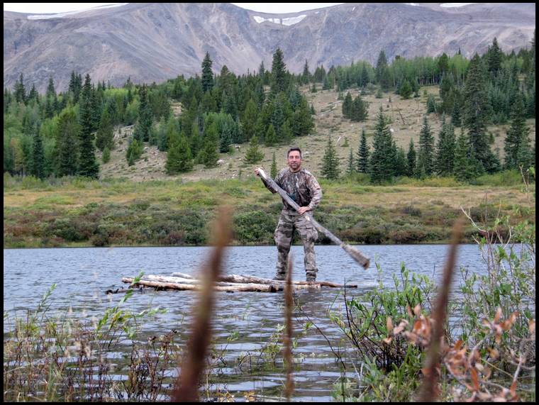
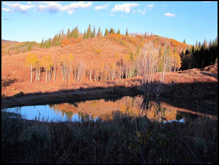
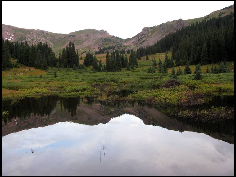
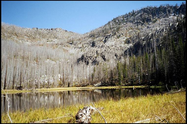
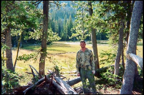
I got there a few days before Elkaddict and set up camp next to a mountain lake.


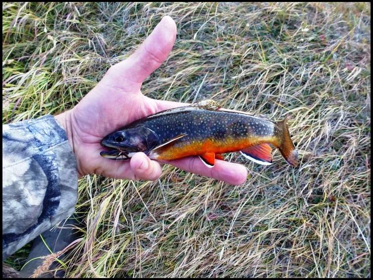
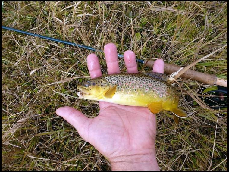
I was pleasantly surprised, these rainbows really fought and put on quite an aerial display!


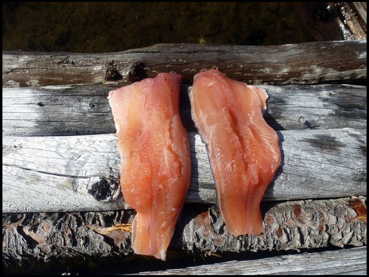


We found another method to cook them that I'll show you later...


It isn't the best for cooking but it gets the job done in a pinch...
My girlfriend bought me a jetboil for Christmas. Les has one but he wasn't there yet and doesn't have the adapter for a frying pan anyway.


It had been there a long time and being a Land Surveyor, I'm guessing that is might have been put up there by surveyors years ago, possibly the USGS to use for triangulating or some other kind of survey work.


While up on top I was able to get a cell signal so I sent Elkaddict the coordinates to my camp since he was on the road and headed west.
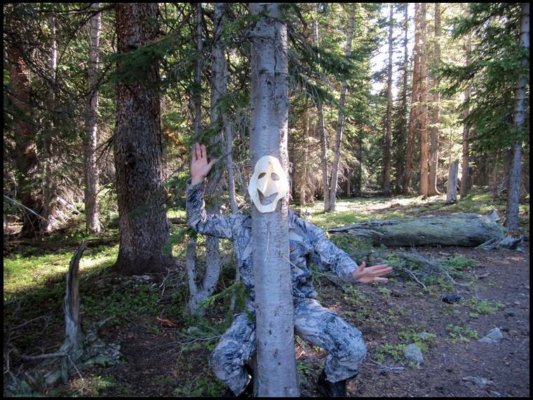
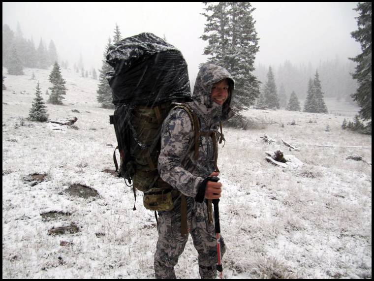
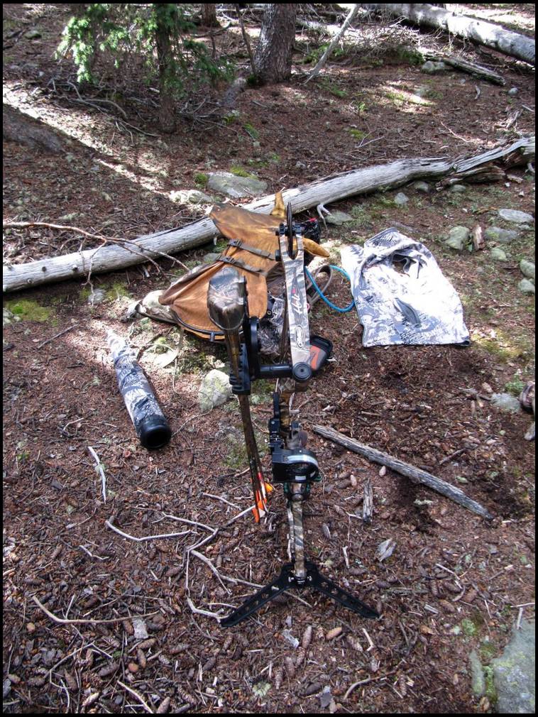
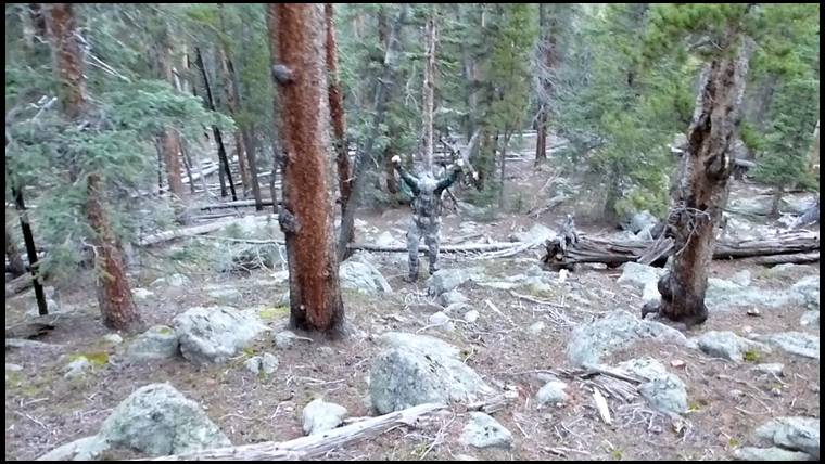
The Sitka Mountain Mimicry camo really blends into the rocks well!
BTW, this will most likely be the last elk hunting trip with my trusty '98 Mathews MQ1 because on Monday I pulled the trigger on a new Mathews Halon 6.


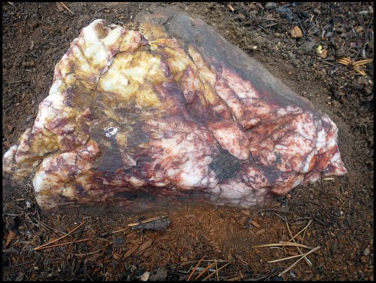

A gold prospector told me once that exposed quartz is an indication that it's a good area to prospect for gold. Don't know if there's any truth to it though.
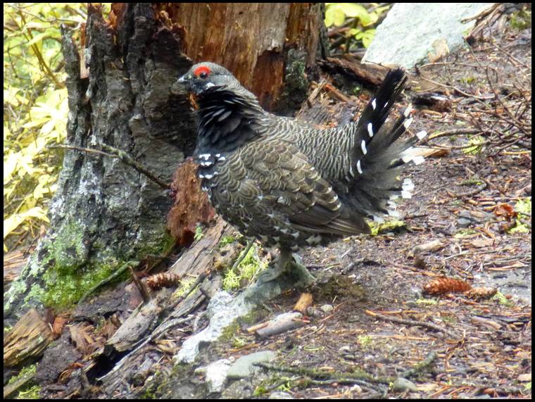

I actually pushed this grouse off of the trail with the toe of my boot.


When I texted him the coordinates of my camp I also sent a picture of a trout and told him he better pack a fishing pole in.
I think he enjoyed this trout fishing a lot more than Wyoming.


As Les pointed out in a previous post, he has the frying pan for his JetBoil but he didn't pack it. We tried various methods for cooking the trout, one of which cost me the hair on my hands and almost cost me my eyebrows and eyelashes!
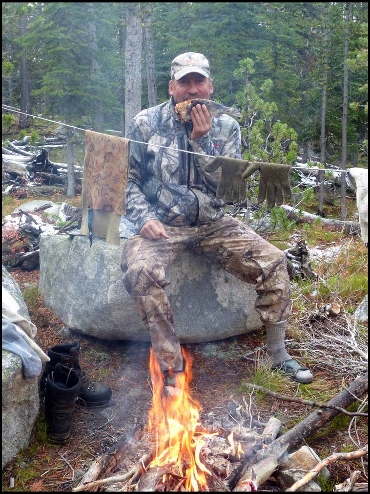
We don't like to have campfires but the weather had turned miserable with occasional peeks of blue sky just to torment us so we had to have a fire to dry out our wet boots and clothes.
We resorted to experimenting with different methods of cooking the trout over the open fire/coals. After we got done, all of our clothes smelled like smoked fish!

I headed out about midday with an empty pack, except for some dirty clothes and made the 6 mile hike down to the truck.
I got there just before dark and just in the nick of time to miss a torrential thunderstorm.
I slept in my truck that night and the next morning I restocked my pack with warm, dry clothes and 8 days worth of food and also packed another 5 days worth of Les's food from a list he gave me.
I made the 6 mile hike that morning back up the mountain and up a seemingly never ending switchback with 75 pounds of food and clothes on my back.
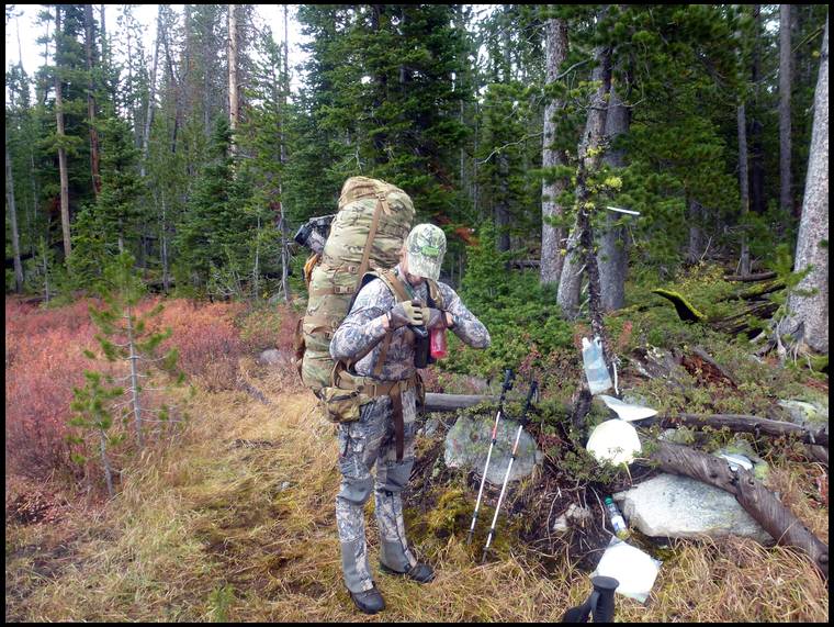

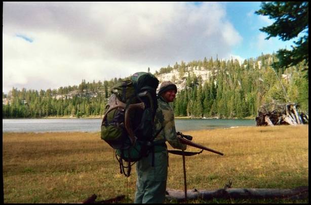
There he was all packed up and ready to head out.
The night before while it was raining on me at the trailhead it had snowed (again) on Les up on the mountain. He had had enough of the miserable weather and absence of elk and was moving on to greener pastures in Colorado.
I had a decision to make; was I going to stay and hunt solo or pack out and go to Colorado with Les? I had just hiked 12 miles in the last 24 hours, the last 6 of which was up the mountain with a 75 pound pack. Now I was considering packing back down the mountain with the rest of my gear in addition to the 8 days worth of food that I just packed up the mountain. I'm sure my pack would weigh at least 80 pounds with all my gear and food and that would mean 12 miles in one day and 18 miles in the last 30 hours. I was already exhausted from the hike in and didn't think I could physically do it.
I considered the options and decided to leave too. I was sick of the weather and the lack of elk here.
Les hit the trail and got a head start on me as I broke down my camp and repacked my backpack and then headed out.
Les got to the truck, dumped his pack, turned around and headed back up the trail and met me about 2 miles from the trailhead. He relieved me of my pack to give me a break and we hiked out to the truck and headed for CO.
In hindsight I/we maybe should have stayed in Montana but the weather had turned miserable and there were no elk or they weren't cooperating. I had only seen one small bull and heard one half-hearted bugle in about 6 days. The possibility of spending the entire elk season without any action was not acceptable to either of us so we headed to a spot in Colorado where we have had success in the past...


Are you guys out of pics yet??


Just wondering, with this thread getting so long and so many pics is anybody having trouble getting it to load? Should we start a second thread?


I have some old pics but cannot find my more recent hunting pics. Not sure what I did with them.


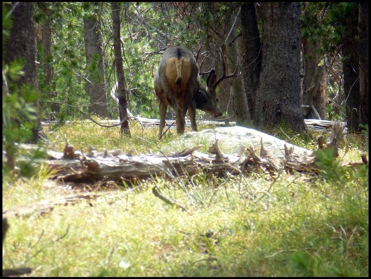
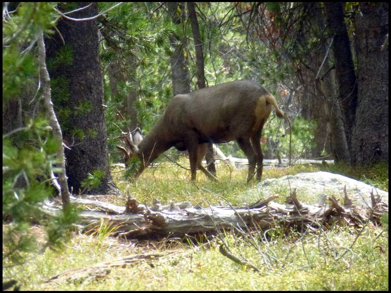
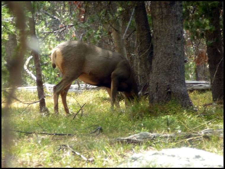
Worst elk hunt I ever had. The guy burned the spot out with so many other hunters. Only four legged animals where mule deer and a cat.
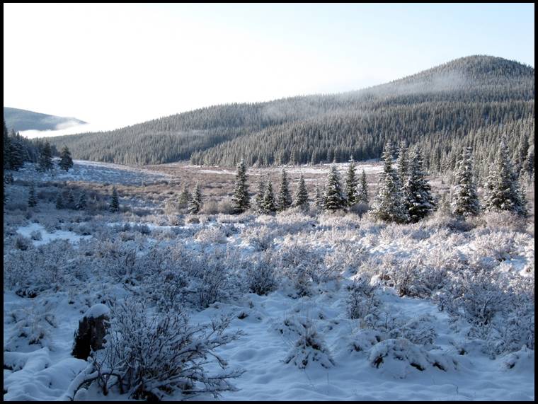
Had a snow day


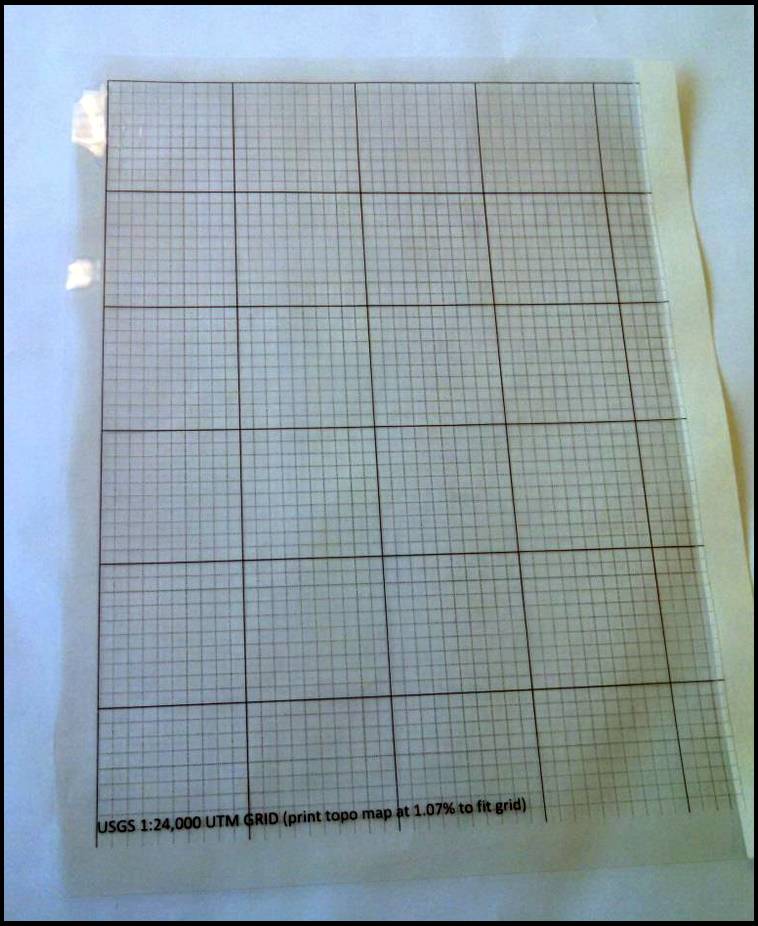

This is a photo of the clear grid overlay that I made and use to scale coordinates on topo maps.
I have a few different versions of this grid in different sizes which fit different maps.
This one is designed to go along with the USGS 7.5 minute quad maps.

Cheesehead Mike's Link
I line up the heavy black grid lines on the clear grid overlay with the UTM coordinate grid lines on the map and then use the fine dashed grid lines to estimate the coordinates of a point on the map or to plot a waypoint that I saved in my GPS. The fine dashed grid lines on the overlay are 100 meters apart.
Usually when I’m out hunting I just cut a chunk of the clear grid and keep it in my GPS case or with my map.
The map that I used in this photo was plotted at a slightly wrong scale so it doesn't quite fit the clear grid but you get the idea. The maps I actually use are printed at a scale that matches the grid lines exactly.
The clear grid overlay is saved in a MS Word document so anybody with MS Word, a printer and a sheet of clear overlay film can print one. If anybody wants a copy, just PM me your email address and I’ll send the file.
Also, if you have access to a large format plotter and you’re interested in printing your own USGS topo maps for free you can go to my attached link.
That's an interesting system. I may have to play around with it. Thanks.

